Area Overview for DE11 1BX
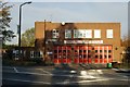
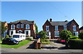
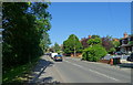
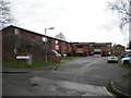
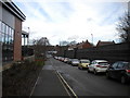
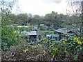
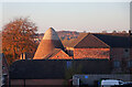
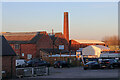
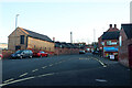
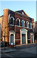
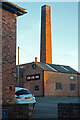
Photos of DE11 1BX

Area Information
DE11 1BX is a small, tightly knit residential postcode in South Derbyshire, nestled within the Swadlincote area. With a population of 2076, it reflects the character of a compact urban community, bordered by Leicestershire and Staffordshire. The area is steeped in history, with records of a market dating to 1251 and growth during the Industrial Revolution. Today, it blends heritage architecture from the early 20th century with modern developments like the Pipeworks scheme, which includes the Odeon cinema and pocket parks. The town centre thrives with independent shops, traditional shopfronts, and a pedestrianised core. Nearby, the Delph market square and Sir Nigel Gresley pub add to its charm. Residents benefit from proximity to Burton upon Trent, Derby, and Ashby-de-la-Zouch, with rail links to Burton and Willington stations. While the area’s population is modest, its commercial vibrancy, including 200+ businesses and a thriving street market, ensures a dynamic daily life.
- Area Type
- Postcode
- Area Size
- Not available
- Population
- 2076
- Population Density
- 3325 people/km²
DE11 1BX is primarily a house-dominated area, with 47% of properties owned by residents. This contrasts with the 53% rental market, indicating a moderate balance between owner-occupation and tenancy. The small size of the postcode means the housing stock is limited, with properties concentrated in the town’s residential clusters. Given the predominance of houses, the area may appeal to families seeking space and privacy, though the compact nature of the postcode means buyers must consider nearby suburbs for additional options. The 47% home ownership rate also suggests that rental properties are available, potentially offering opportunities for investors. However, the limited scale of the area means property availability is constrained, and buyers should assess the broader Swadlincote region for more choices. The mix of heritage and modern homes reflects a blend of traditional appeal and contemporary living.
House Prices in DE11 1BX
No properties found in this postcode.
Energy Efficiency in DE11 1BX
DE11 1BX offers a range of amenities within practical reach, including five retail outlets such as Lidl Castle, Morrisons Castle, and Iceland Swadlincote, ensuring everyday shopping needs are met. The town’s commercial core features independent shops, high-street brands, and a thriving street market, adding to its vibrancy. Leisure options include the Swadlincote Snowsports Centre and the Odeon cinema, while the Delph market square and Sir Nigel Gresley pub contribute to a social atmosphere. The area’s mix of heritage architecture and modern developments, such as the Pipeworks scheme, reflects a balance between tradition and contemporary living. The presence of nearby rail stations and a bustling bus network enhances convenience, making daily life in DE11 1BX both practical and engaging.
Amenities
Schools
The nearest school to DE11 1BX is Belmont Primary School, which serves the local community with a good Ofsted rating. As a primary school, it provides essential early education for children aged 4–11, though secondary schooling options are not explicitly listed in the data. The presence of a rated primary school is a key consideration for families, offering a foundation for education. However, the absence of secondary schools in the immediate vicinity may require families to look further afield, potentially increasing commuting times. The school’s good rating suggests a focus on quality teaching and resources, though parents should verify if additional educational needs are met by nearby institutions. For families prioritising primary education, Belmont Primary School is a reliable choice within the area.
| Rank | School | Type | Entry gender | Ages |
|---|
Explore more schools in this area
Go to Schools tabDemographics
The median age in DE11 1BX is 47, with the most common age range being adults aged 30–64. This suggests a mature, stable community with a focus on family life and established careers. Home ownership stands at 47%, indicating a mix of owner-occupied properties and rental units. The predominant accommodation type is houses, reflecting a preference for single-family homes over flats. The predominant ethnic group is White, though specific diversity data is not provided. The area’s moderate population size and age profile suggest a balanced demographic, with fewer young families compared to larger urban centres. The 47% home ownership rate implies a rental market that may cater to younger professionals or those seeking flexibility. The absence of detailed deprivation data means quality of life factors like access to services and infrastructure must be inferred from the availability of amenities and transport links.
Household Size
Accommodation Type
Tenure
Ethnic Group
Religion
Household Composition
Age
Household Deprivation
NS-SEC
Explore more demographic insights in this area
Go to Demographics tabPlanning
Planning Constraints
- Flood RiskPremium
- Ramsar Wetland SitesPremium
- Area of Outstanding Natural BeautyPremium
- Protected Nature ReservePremium
- Protected WoodlandPremium