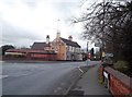
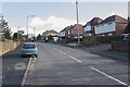
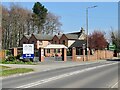
Area Overview for DE11 0XN
Photos of DE11 0XN
Area Information
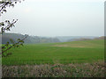
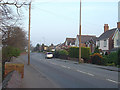
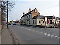
DE11 0XN is a small, densely populated residential postcode in South Derbyshire, England, covering 3,061 m² and home to 1,410 people. Its high population density of 460,565 people per km² reflects a compact, closely knit community. Nestled within the Midway Ward, this area has roots in historical mining and industrial activity, with ties to the former Swadlincote Urban District. Today, it forms part of the wider Swadlincote urban area, blending residential living with remnants of its industrial past. The area’s proximity to Gresley, Stanton, and Newhall adds to its regional character. Daily life here is shaped by its small-scale nature, with residents relying on nearby amenities and transport links. The presence of listed buildings like Midway Farm and Eureka Park’s heritage sites hints at a community that values its history while adapting to modern needs. Living in DE11 0XN means navigating a tight-knit environment with limited space but strong local connections.
- Area Type
- Postcode
- Area Size
- 3061 m²
- Population
- 1410
- Population Density
- 2809 people/km²
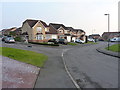
DE11 0XN is a predominantly owner-occupied area, with 90% of homes owned by their residents. The accommodation type is exclusively houses, indicating a lack of rental properties or flats. This suggests a market skewed towards long-term homeownership, with limited opportunities for renters. The small area size of 3,061 m² implies a constrained housing stock, potentially limiting availability for buyers. The dominance of houses over other property types may appeal to those seeking family homes or larger living spaces. However, the compact nature of the area means buyers should consider nearby regions for additional options. The high home ownership rate also suggests a stable market with lower turnover, which could be advantageous for those seeking a secure investment. Prospective buyers should note that the area’s size and housing stock may require a broader search beyond DE11 0XN for more choices.
House Prices in DE11 0XN
Showing 12 properties
| Address | Type | Beds | Baths | Last Sale Price | Last Sale Date | |
|---|---|---|---|---|---|---|
| 9 Wheatlands, Midway, Swadlincote, DE11 0XN | Semi-detached | 3 | 1 | £190,000 | Aug 2025 | |
| 1 Wheatlands, Midway, Swadlincote, DE11 0XN | Semi-detached | 3 | 1 | £169,000 | Aug 2019 | |
| 8 Wheatlands, Midway, Swadlincote, DE11 0XN | Semi-detached | 3 | 1 | £154,950 | Jan 2017 | |
| 3 Wheatlands, Midway, Swadlincote, DE11 0XN | Semi-detached | 3 | - | £119,950 | Aug 2005 | |
| 11 Wheatlands, Midway, Swadlincote, DE11 0XN | Semi-detached | - | - | £130,000 | May 2005 | |
| 10 Wheatlands, Midway, Swadlincote, DE11 0XN | Semi-detached | - | - | £125,000 | Jun 2004 | |
| 2 Wheatlands, Midway, Swadlincote, DE11 0XN | house | 3 | - | £86,000 | Apr 2003 | |
| 15 Wheatlands, Midway, Swadlincote, DE11 0XN | Semi-detached | 3 | 1 | £53,000 | May 2000 | |
| 4 Wheatlands, Midway, Swadlincote, DE11 0XN | Semi-detached | - | - | - | - | |
| 5 Wheatlands, Midway, Swadlincote, DE11 0XN | Detached | - | - | - | - |
Energy Efficiency in DE11 0XN
Residents of DE11 0XN have access to essential retail and transport amenities within practical reach. Nearby shops include Sainsburys Newhall, Sainsburys Swadlincote, and Lidl Castle, providing grocery and everyday shopping options. The area’s proximity to two railway stations—Burton and Willington—offers regional connectivity, though the nearest stations are a short drive away. For leisure, Eureka Park and Midway Farm offer historical and natural attractions, with the latter featuring 19th-century listed buildings. The area’s small size means local amenities are concentrated, requiring residents to travel slightly for broader services. The presence of retail outlets and transport links supports a convenient lifestyle, though the compact nature of the postcode may limit the variety of leisure options. Overall, daily life in DE11 0XN balances proximity to essentials with the need for regional travel for more diverse experiences.
Amenities
Schools
| Rank | School | Type | Entry gender | Ages |
|---|
Explore more schools in this area
Go to Schools tabDemographics
The population of DE11 0XN is predominantly adults aged 30–64, with a median age of 47. This suggests a mature, stable community with a high proportion of homeowners—90% of households own their homes. The area is characterised by houses rather than flats, reflecting a preference for single-family dwellings. The predominant ethnic group is White, though specific diversity data is not provided. The high home ownership rate and age profile indicate a community likely focused on long-term residency rather than transient populations. The population density of 460,565 people per km² means living spaces are closely packed, which may influence local dynamics and the character of public spaces. For prospective buyers, this demographic profile suggests a neighbourhood with established social networks and a focus on family-oriented living, though the lack of younger residents may affect school populations and local services.
Household Size
Accommodation Type
Tenure
Ethnic Group
Religion
Household Composition
Age
Household Deprivation
NS-SEC
Explore more demographic insights in this area
Go to Demographics tabPlanning
Planning Constraints
- Flood RiskPremium
- Ramsar Wetland SitesPremium
- Area of Outstanding Natural BeautyPremium
- Protected Nature ReservePremium
- Protected WoodlandPremium