Area Overview for DE11 0XG
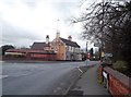
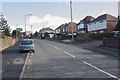
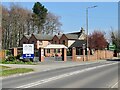
Photos of DE11 0XG
Area Information
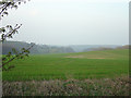
Living in DE11 0XG means being part of a tightly knit residential cluster in the heart of South Derbyshire. This small postcode area, covering just 6,537 square metres, is home to 1,410 people, creating a densely populated yet manageable community. Nestled within the broader Swadlincote urban area, the postcode is steeped in industrial history, once shaped by coal and clay extraction. Today, it blends this heritage with modern living, offering a quiet, stable environment. The area’s proximity to Swadlincote and its historical ties to Church Gresley and Newhall provide a sense of continuity. Residents benefit from nearby amenities, including retail hubs and rail links, while the low crime rate and flood risk contribute to a secure lifestyle. With a population density of 215,681 people per square kilometre, DE11 0XG is a compact, focused community where daily life is defined by local connections and practical convenience.
- Area Type
- Postcode
- Area Size
- 6537 m²
- Population
- 1410
- Population Density
- 2809 people/km²
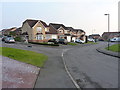
The property market in DE11 0XG is characterised by high home ownership, with 90% of residents living in owner-occupied homes. This suggests a stable, long-term resident base with little reliance on rental properties. The accommodation type is predominantly houses, which aligns with the area’s compact size and the preference for private, detached living. Given the small postcode area, the housing stock is likely limited to a few hundred properties, making it a niche market for buyers seeking a quiet, established community. The focus on homeownership means fewer rental options, which could be advantageous for those prioritising security and equity. Buyers should consider the proximity to Swadlincote and the surrounding areas for broader property choices, though DE11 0XG itself offers a distinct, localised feel.
House Prices in DE11 0XG
Showing 17 properties
| Address | Type | Beds | Baths | Last Sale Price | Last Sale Date | |
|---|---|---|---|---|---|---|
| 19 Top Meadow, Midway, Swadlincote, DE11 0XG | Detached | 3 | 2 | £290,000 | Dec 2025 | |
| 17 Top Meadow, Midway, Swadlincote, DE11 0XG | Detached | 4 | 2 | £324,000 | Dec 2025 | |
| 11 Top Meadow, Midway, Swadlincote, DE11 0XG | Detached | 4 | 3 | £270,000 | Jan 2023 | |
| 7 Top Meadow, Midway, Swadlincote, DE11 0XG | Semi-detached | 3 | 1 | £173,000 | Nov 2019 | |
| 3 Top Meadow, Midway, Swadlincote, DE11 0XG | Semi-detached | 3 | 1 | £155,000 | Jul 2018 | |
| 8 Top Meadow, Midway, Swadlincote, DE11 0XG | house | - | - | £185,000 | Dec 2016 | |
| 6 Top Meadow, Midway, Swadlincote, DE11 0XG | house | - | - | £129,000 | Feb 2015 | |
| 4 Top Meadow, Midway, Swadlincote, DE11 0XG | house | - | - | £115,000 | Mar 2011 | |
| 2 Top Meadow, Midway, Swadlincote, DE11 0XG | Detached | - | - | £174,000 | Mar 2007 | |
| 1 Top Meadow, Midway, Swadlincote, DE11 0XG | house | - | - | £109,000 | Oct 2004 |
Energy Efficiency in DE11 0XG
Residents of DE11 0XG have access to a range of amenities within practical reach, enhancing daily life. Retail options include Sainsburys Swadlincote, Sainsburys Newhall, and Lidl Castle, ensuring convenience for grocery shopping. The area’s historical character is complemented by nearby attractions such as Eureka Park, which features mining heritage sites like the 1906 tram sheds, and Midway Farm, home to listed 19th-century buildings. These landmarks add cultural and recreational value, offering both leisure and a connection to the region’s industrial past. While the postcode itself is small, its proximity to Swadlincote expands access to more extensive services. The blend of practical amenities and historical sites creates a lifestyle that balances modern convenience with local identity.
Amenities
Schools
| Rank | School | Type | Entry gender | Ages |
|---|
Explore more schools in this area
Go to Schools tabDemographics
DE11 0XG’s population skews towards adults aged 30–64, with a median age of 47, reflecting a mature, established community. Over 90% of residents own their homes, a figure that underscores the area’s stability and long-term residency. The predominant accommodation type is houses, aligning with the high home ownership rate and suggesting a preference for family-friendly or semi-detached living. The predominant ethnic group is White, with no specific data on diversity beyond this. The absence of significant deprivation data means the area likely benefits from a higher standard of living, supported by its low crime score and access to essential services. This demographic profile indicates a community focused on comfort, security, and continuity, with residents likely prioritising homeownership and family-oriented lifestyles.
Household Size
Accommodation Type
Tenure
Ethnic Group
Religion
Household Composition
Age
Household Deprivation
NS-SEC
Explore more demographic insights in this area
Go to Demographics tabPlanning
Planning Constraints
- Flood RiskPremium
- Ramsar Wetland SitesPremium
- Area of Outstanding Natural BeautyPremium
- Protected Nature ReservePremium
- Protected WoodlandPremium