Area Overview for DE11 0UZ
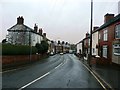
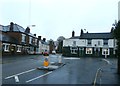
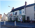
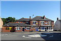
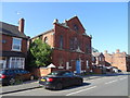
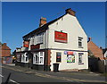
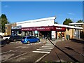
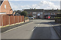
Photos of DE11 0UZ

Area Information
DE11 0UZ is a compact residential postcode in South Derbyshire, England, encompassing parts of the Newhall and Stanton villages. With a population of 1,740 spread across 9,245 square metres, it is a densely populated area characterised by a mix of historical and modern influences. The ward, known as Newhall and Stanton, sits between Swadlincote to the south and Burton upon Trent to the west, with proximity to major roads like the A444 and A511. This small cluster of homes reflects a community rooted in 18th-century industrial heritage, including coal and clay extraction, yet it remains a quiet residential hub. The area’s median age of 47 suggests a mature population, with a strong presence of adults aged 30–64. High home ownership (71%) and a predominantly White demographic underscore a stable, family-oriented environment. Residents benefit from nearby towns like Swadlincote and Burton, offering amenities and transport links, while the area’s compact size fosters a close-knit community feel.
- Area Type
- Postcode
- Area Size
- 9245 m²
- Population
- 1740
- Population Density
- 3452 people/km²
The property market in DE11 0UZ is predominantly owner-occupied, with 71% of homes owned by residents rather than rented. The accommodation type is largely houses, which is typical of small residential clusters in rural or semi-rural settings. This suggests a market skewed towards family homes and long-term residency rather than short-term rental properties. The area’s small size means the housing stock is limited, with buyers needing to consider nearby towns like Swadlincote and Burton upon Trent for broader options. The high home ownership rate indicates a stable market, potentially offering good value for those seeking a permanent residence. However, the compact nature of the area may limit inventory, making it essential for buyers to act decisively. For those prioritising proximity to local amenities and a quiet lifestyle, DE11 0UZ offers a blend of traditional housing and community-focused living.
House Prices in DE11 0UZ
Showing 9 properties
| Address | Type | Beds | Baths | Last Sale Price | Last Sale Date | |
|---|---|---|---|---|---|---|
| 2 Tilley Green, Newhall, Swadlincote, DE11 0UZ | Semi-detached | 2 | - | £167,000 | Mar 2021 | |
| 4 Tilley Green, Newhall, Swadlincote, DE11 0UZ | Bungalow | - | - | £165,500 | Dec 2020 | |
| 5 Tilley Green, Newhall, Swadlincote, DE11 0UZ | Bungalow | 2 | 1 | £141,000 | Oct 2013 | |
| 9 Tilley Green, Newhall, Swadlincote, DE11 0UZ | Bungalow | - | - | £133,000 | Oct 2013 | |
| 1 Tilley Green, Newhall, Swadlincote, DE11 0UZ | Bungalow | 2 | - | £140,000 | May 2008 | |
| 6 Tilley Green, Newhall, Swadlincote, DE11 0UZ | Bungalow | 2 | 1 | £143,750 | May 2007 | |
| 7 Tilley Green, Newhall, Swadlincote, DE11 0UZ | Detached | - | - | £139,950 | Mar 2007 | |
| 8 Tilley Green, Newhall, Swadlincote, DE11 0UZ | Detached | - | - | £135,000 | Feb 2007 | |
| 3 Tilley Green, Newhall, Swadlincote, DE11 0UZ | Bungalow | - | - | £119,950 | Mar 2006 |
Energy Efficiency in DE11 0UZ
Daily life in DE11 0UZ is supported by a range of nearby amenities, including five retail outlets such as Sainsburys Newhall, Sainsburys Swadlincote, and Tesco Swadlincote, ensuring easy access to shopping and essential services. The area’s proximity to Burton upon Trent and Swadlincote adds to its convenience, offering additional leisure, dining, and cultural options. Local parks, such as Newhall Park, provide green spaces for recreation, while historical sites like St John’s Anglican Church and listed buildings add character to the community. The mix of retail, transport, and natural spaces creates a balanced lifestyle, blending practicality with the charm of a small village setting. Residents benefit from a compact yet well-served environment, ideal for those seeking a relaxed yet connected way of life.
Amenities
Schools
Residents of DE11 0UZ have access to several educational institutions, including Newhall Infant School, a primary school with a ‘good’ Ofsted rating, and William Allitt School, another primary school. Additional facilities include South Derbyshire Support Centre, Newhall Support Centre, and Esteem South Academy, which cater to specialist or alternative education needs. The mix of primary schools and support centres reflects a comprehensive approach to education, ensuring families have options for both mainstream and tailored learning. For parents, this diversity means flexibility in choosing schools that align with their children’s needs, whether for standard education or additional support. The presence of multiple schools within practical reach underscores the area’s suitability for families prioritising accessible, high-quality education.
| Rank | School | Type | Entry gender | Ages |
|---|
Explore more schools in this area
Go to Schools tabDemographics
The population of DE11 0UZ is 1,740, with a median age of 47 and the most common age range being adults aged 30–64. This suggests a mature, established community with a focus on family life and long-term residency. Home ownership is high at 71%, indicating a strong presence of owner-occupied properties, which is typical of small rural or semi-rural areas. The predominant accommodation type is houses, reflecting a suburban or village character rather than high-density housing. The predominant ethnic group is White, with no specific data provided on other ethnicities. The high population density of 188,215 people per square kilometre highlights the area’s compact nature, which, combined with the age profile, points to a stable, low-turnover community. This demographic profile implies a focus on quality of life, with residents likely prioritising proximity to local amenities, schools, and transport links.
Household Size
Accommodation Type
Tenure
Ethnic Group
Religion
Household Composition
Age
Household Deprivation
NS-SEC
Explore more demographic insights in this area
Go to Demographics tabPlanning
Planning Constraints
- Flood RiskPremium
- Ramsar Wetland SitesPremium
- Area of Outstanding Natural BeautyPremium
- Protected Nature ReservePremium
- Protected WoodlandPremium