Area Overview for DE11 0QE
Photos of DE11 0QE
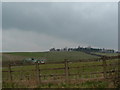
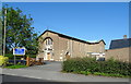
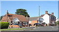
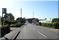
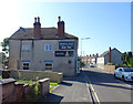
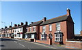
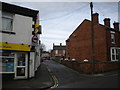
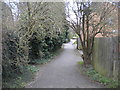
16 photos from this area
Area Information
Key information about the DE11 0QE including its size, population, and administrative classification.
- Area Type
- Postcode
- Area Size
- 1.0 hectares
- Population
- 1840
- Population Density
- 3525 people/km²
House Prices in DE11 0QE
33
Properties
£131,364
Average Sold Price
£80,000
Lowest Price
£195,000
Highest Price
Showing 33 properties
| Address | Type | Beds | Baths | Last Sale Price | Last Sale Date | |
|---|---|---|---|---|---|---|
| 63 Valley Rise, Swadlincote, DE11 0QE | Detached | 3 | 1 | £195,000 | Nov 2025 | |
| 67 Valley Rise, Swadlincote, DE11 0QE | Semi-detached | 3 | 1 | £177,500 | Apr 2025 | |
| 50 Valley Rise, Swadlincote, DE11 0QE | Semi-detached | 3 | 1 | £162,000 | Feb 2022 | |
| 72 Valley Rise, Swadlincote, DE11 0QE | house | - | - | £140,000 | Sep 2021 | |
| 43B Valley Rise, Swadlincote, DE11 0QE | Semi-detached | 2 | 1 | £150,000 | Mar 2021 | |
| 43A Valley Rise, Swadlincote, DE11 0QE | house | - | - | £147,500 | Mar 2020 | |
| 47 Valley Rise, Swadlincote, DE11 0QE | house | - | - | £100,000 | May 2016 | |
| 45 Valley Rise, Swadlincote, DE11 0QE | Semi-detached | 3 | 1 | £82,000 | Jul 2013 | |
| 51 Valley Rise, Swadlincote, DE11 0QE | Semi-detached | 3 | 1 | £100,000 | Feb 2013 | |
| 46 Valley Rise, Swadlincote, DE11 0QE | house | 3 | - | £80,000 | Nov 2011 |
Page 1 of 4
Energy Efficiency in DE11 0QE
Amenities
Schools
| Rank | School | Type | Entry gender | Ages |
|---|
Explore more schools in this area
Go to Schools tabDemographics
Household Size
Two person
most common
Accommodation Type
Houses
most common
Tenure
73
majority
Ethnic Group
White
most common
Religion
N/A
most common
Household Composition
N/A
most common
Age
47
median
Adults (30-64 years)
most common
Household Deprivation
N/A
with no deprivation
NS-SEC
25
in Lower managerial occupations
Explore more demographic insights in this area
Go to Demographics tabPlanning
Planning Constraints
- Flood RiskPremium
- Ramsar Wetland SitesPremium
- Area of Outstanding Natural BeautyPremium
- Protected Nature ReservePremium
- Protected WoodlandPremium