Area Overview for DE11 0GH
Photos of DE11 0GH
Area Information
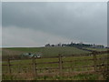
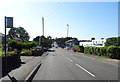
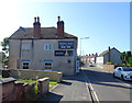
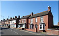
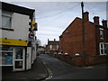
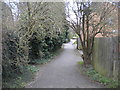
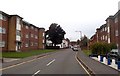
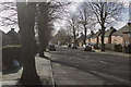
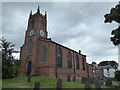
Living in DE11 0GH means being part of a small, tightly knit residential cluster in South Derbyshire, nestled between Swadlincote and Burton upon Trent. This postcode area, part of the Newhall and Stanton ward, has a population of 1,530, reflecting a quiet, low-density settlement shaped by 18th-century industrial roots in coal and clay. The area’s character is defined by its proximity to major roads like the A444 and A511, linking it to nearby towns and motorways. Daily life here balances rural tranquillity with practical access to services. The ward’s history includes a greyhound racing track from 1930 and a composite war memorial in Newhall Park, hinting at a community with both historical depth and modern convenience. Residents benefit from nearby amenities such as Sainsburys and Lidl, while the area’s small size fosters a sense of familiarity. For those seeking a place with a manageable population and a mix of traditional and contemporary elements, DE11 0GH offers a distinct blend of quiet living and strategic connectivity.
- Area Type
- Postcode
- Area Size
- Not available
- Population
- 1530
- Population Density
- 4880 people/km²
The property market in DE11 0GH is characterised by a 45% home ownership rate, suggesting a balance between owner-occupied homes and rental properties. The accommodation type is predominantly houses, which aligns with the area’s small, residential nature. This implies a market skewed towards family homes rather than apartments or flats, making it more appealing to those seeking traditional housing. Given the low population density and the area’s proximity to larger towns like Burton upon Trent and Swadlincote, properties here may cater to commuters or those preferring a quieter lifestyle. Buyers should consider that the small size of the postcode area means housing stock is limited, potentially leading to competition. The predominance of houses also suggests that the market may be more stable, with fewer speculative developments compared to areas with higher-density housing.
House Prices in DE11 0GH
No properties found in this postcode.
Energy Efficiency in DE11 0GH
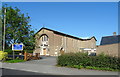
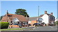
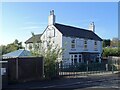
Residents of DE11 0GH have access to a range of local amenities within practical reach. Retail options include Sainsburys Newhall, Sainsburys Swadlincote, and Lidl Castle, providing everyday shopping convenience. The area’s proximity to the A444 and A511 roads also facilitates travel to larger towns for more specialised services. For leisure, Newhall Park hosts a composite war memorial, offering a space for reflection and community gatherings. The nearby villages of Newhall and Stanton retain a traditional character, with listed buildings and historical sites such as the bottle-shaped kiln in Swadlincote. While the area lacks large-scale entertainment venues, its small size fosters a sense of simplicity and ease of access to nearby amenities. The presence of multiple retail outlets and transport links ensures that daily life remains functional without the need for long commutes, balancing local convenience with regional connectivity.
Amenities
Schools
| Rank | School | Type | Entry gender | Ages |
|---|
Explore more schools in this area
Go to Schools tabDemographics
The community in DE11 0GH is predominantly composed of adults aged 30–64, with a median age of 47. This suggests a mature, stable population, likely with established careers and families. Home ownership stands at 45%, indicating a mix of owner-occupied properties and rental homes, though the exact proportion of renters is not specified. The area’s accommodation is largely houses, reflecting a residential character rather than high-density housing. The predominant ethnic group is White, though no further breakdown of diversity is provided. The population size of 1,530 implies a close-knit community where social ties may be strong. The absence of specific data on deprivation or income levels means that quality of life considerations such as affordability or access to services must be inferred from other factors, like the availability of nearby amenities and transport links.
Household Size
Accommodation Type
Tenure
Ethnic Group
Religion
Household Composition
Age
Household Deprivation
NS-SEC
Explore more demographic insights in this area
Go to Demographics tabPlanning
Planning Constraints
- Flood RiskPremium
- Ramsar Wetland SitesPremium
- Area of Outstanding Natural BeautyPremium
- Protected Nature ReservePremium
- Protected WoodlandPremium