Area Overview for DE1 3NU
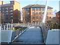
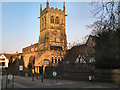
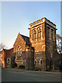
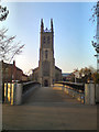
Photos of DE1 3NU

Area Information
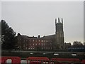
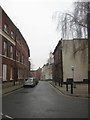
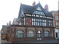
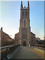
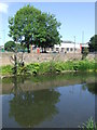
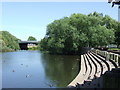
Living in DE1 3NU means being part of a small, tightly knit residential cluster in Derby, England. With a population of 1,578, the area is compact but rich in history, situated along the River Derwent. It forms part of the Derwent Valley Mills World Heritage Site, a legacy of 18th-century industrial innovation. The area became part of Derby in 1968 and retains its character through historic terraced housing, including the oldest surviving "cluster" housing in England. Daily life here is shaped by proximity to rail networks, retail hubs, and the city’s cultural fabric. Young adults dominate the demographic, with 7% of homes owner-occupied and the rest rented. This makes the area a hub for transient populations, including students and young professionals. The presence of independent schools and strong rail links to Derby’s central stations adds to its appeal for families seeking convenience. However, the area’s small size means its character is defined by its historical roots and modern-day practicalities, such as access to nearby supermarkets and transport.
- Area Type
- Postcode
- Area Size
- Not available
- Population
- Not available
- Population Density
- Not available
The property market in DE1 3NU is heavily rental-focused, with only 7% of homes owner-occupied. This reflects a small, transient population, likely dominated by young adults and students. The accommodation type is predominantly flats, a legacy of the 18th-century industrial housing developments that created terraced clusters like Flat Square and West Row. These historic homes, while characterful, may not appeal to buyers seeking larger properties. The area’s compact size means the housing stock is limited, and the immediate surroundings offer few alternative options. For buyers, this suggests a niche market where properties are likely to be rented out rather than held long-term. The low home ownership rate also indicates limited demand for owner-occupied homes, which could affect property value growth. Investors may find opportunities, but buyers should consider the area’s small scale and rental-oriented nature.
House Prices in DE1 3NU
No properties found in this postcode.
Energy Efficiency in DE1 3NU
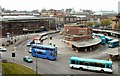
Residents of DE1 3NU have access to a range of nearby amenities that support daily life. Retail options include major supermarkets like Tesco Derby St, Iceland Albion, and Asda Derby, ensuring convenience for grocery shopping. The area’s rail network, with stations such as Derby and Spondon, connects it to Derby’s city centre and surrounding areas, making commuting and travel straightforward. While the data does not specify parks or leisure facilities, the proximity to Derby’s broader infrastructure suggests opportunities for recreation and cultural activities in the city. The historic character of the area, including its 18th-century terraced housing, adds to its distinctiveness. However, the small size of DE1 3NU means that residents may need to venture slightly further for more extensive amenities, though the existing retail and transport links provide a solid foundation for everyday needs.
Amenities
Schools
The nearest school to DE1 3NU is Rathbone Training – Derby Centre, an independent school. This type of institution typically offers fee-paying education, which may appeal to families seeking private schooling options. However, the data does not include Ofsted ratings or academic performance details. The presence of an independent school suggests the area may attract households prioritising private education, though the limited number of schools nearby means families may need to travel for state education. For those relying on local state schools, the data does not specify other options, so proximity to Derby’s broader school network would be key. The mix of school types here is limited, with only one listed, which could impact choices for families seeking a range of educational environments.
| Rank | School | Type | Entry gender | Ages |
|---|
Explore more schools in this area
Go to Schools tabDemographics
DE1 3NU has a median age of 22, with the most common age range being 15–29 years. This reflects a community skewed towards young adults, likely including students and early-career professionals. Only 7% of homes are owner-occupied, indicating a rental-dominated market. The predominant accommodation type is flats, aligning with the area’s history of terraced housing and industrial-era planning. The predominant ethnic group is White, with no data provided on other demographics. The low home ownership rate suggests a transient population, which may impact community cohesion. For quality of life, this demographic profile means services and amenities must cater to younger residents, such as affordable housing and transport links. The area’s small size and focus on rental properties also mean it may lack long-term investment in local infrastructure compared to more established neighbourhoods.
Household Size
Accommodation Type
Tenure
Ethnic Group
Religion
Household Composition
Age
Household Deprivation
NS-SEC
Explore more demographic insights in this area
Go to Demographics tabPlanning
Planning Constraints
- Flood RiskPremium
- Ramsar Wetland SitesPremium
- Area of Outstanding Natural BeautyPremium
- Protected Nature ReservePremium
- Protected WoodlandPremium