Area Overview for DE1 3DR
Photos of DE1 3DR

Area Information
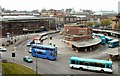
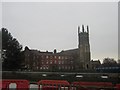
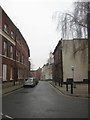
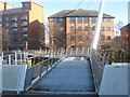
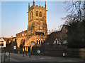
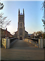
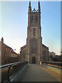
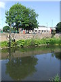
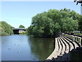
Living in DE1 3DR means being part of a tightly knit residential cluster in Derby, England, nestled along the River Derwent. This area, part of Darley Ward, is steeped in history as a former industrial hub, now integrated into Derby’s urban fabric. The postcode covers just 1834 square metres, housing 1578 residents in a densely populated setting. With a median age of 22, the community is young, dominated by individuals aged 15–29. The area’s heritage as a mill village from the 18th century, including the Boar’s Head Mills, adds a layer of historical significance, though modern life here is defined by proximity to retail, rail, and the city’s infrastructure. Residents benefit from nearby railway stations and a range of shops, yet the compact size means the area feels both intimate and connected to Derby’s broader networks. For those seeking a blend of history and contemporary convenience, DE1 3DR offers a distinct character shaped by its past and present.
- Area Type
- Postcode
- Area Size
- 1834 m²
- Population
- Not available
- Population Density
- Not available
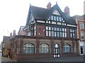
The property market in DE1 3DR is heavily rental-focused, with only 7% of homes owned by residents. The accommodation type is almost exclusively flats, a legacy of the area’s 18th-century industrial planning, where workers were housed in terraced clusters. This means the housing stock is limited in size and primarily suited to single occupants or small households. For buyers, the small area’s immediate surroundings offer little variation in property types, reinforcing a market where owner-occupation is rare. The high density and flat-dominated landscape suggest that those seeking larger homes or suburban settings may find DE1 3DR unsuitable. However, the proximity to Derby’s rail network and retail hubs could appeal to renters prioritising location over property size.
House Prices in DE1 3DR
Showing 1 properties
| Address | Type | Beds | Baths | Last Sale Price | Last Sale Date | |
|---|---|---|---|---|---|---|
| The Derby Diocesan Board Of Finance Ltd, Derby Church House, Full Street, Derby, DE1 3DR | Office | - | - | - | - |
Energy Efficiency in DE1 3DR
Daily life in DE1 3DR is shaped by its proximity to retail and transport hubs. Residents can access five retail venues, including Asda Derby and Iceland Albion, ensuring grocery and household needs are met locally. The area’s rail network, with stations like Derby and Spondon, provides easy access to Derby’s cultural and employment centres. While parks or green spaces are not explicitly listed, the River Derwent’s presence adds a natural element to the surroundings. The compact layout means amenities are within walking or short transit distance, fostering a sense of convenience. However, the lack of detailed information on leisure facilities suggests that residents may need to venture slightly beyond the postcode for recreational activities. The blend of retail, rail, and historical context creates a lifestyle that balances practicality with the area’s heritage.
Amenities
Schools
The nearest school to DE1 3DR is Rathbone Training – Derby Centre, an independent institution. No Ofsted rating is provided, but its independent status suggests it may cater to families seeking alternative education models. The absence of state schools in the immediate vicinity means families relying on public education would need to look beyond the postcode. This could be a consideration for buyers prioritising school catchment areas, though the presence of a single independent option may reflect the area’s smaller scale. For those valuing private schooling, Rathbone Training offers a dedicated option, but its suitability depends on specific educational preferences and financial capacity.
| Rank | School | Type | Entry gender | Ages |
|---|
Explore more schools in this area
Go to Schools tabDemographics
DE1 3DR’s population of 1578 is overwhelmingly young, with a median age of 22 and the majority aged 15–29. This reflects a community skewed toward students, early-career professionals, or those in transitional life stages. Home ownership is exceptionally low at 7%, indicating a rental-dominated market. The accommodation type is predominantly flats, a reflection of the area’s compact footprint and historical development as a mill village. The predominant ethnic group is White, though specific diversity metrics are not provided. The high population density of 860,360 people per square kilometre underscores the area’s intensity, which may impact living space and community dynamics. For buyers, this demographic profile suggests a transient population, with housing needs likely focused on short-term or flexible tenancies rather than long-term ownership.
Household Size
Accommodation Type
Tenure
Ethnic Group
Religion
Household Composition
Age
Household Deprivation
NS-SEC
Explore more demographic insights in this area
Go to Demographics tabPlanning
Planning Constraints
- Flood RiskPremium
- Ramsar Wetland SitesPremium
- Area of Outstanding Natural BeautyPremium
- Protected Nature ReservePremium
- Protected WoodlandPremium