Area Overview for DE1 2RS
Photos of DE1 2RS

Area Information
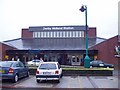
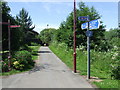
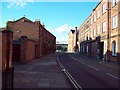
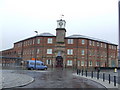
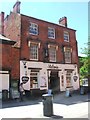
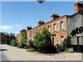
Living in DE1 2RS means being part of a small, tightly knit residential cluster in Derby, a city in the East Midlands. The area has a population of 1,269, reflecting its compact nature. While not a sprawling suburb, it offers proximity to Derby’s historic and cultural landmarks, including the Derby Arboretum, a Grade II* listed park gifted to the city in 1840. This area is defined by its quiet residential character, with a focus on flats as the primary accommodation type. Daily life here balances local amenities with easy access to Derby’s broader infrastructure. Residents benefit from nearby rail stations such as Derby, Peartree, and Spondon, which connect to regional transport networks. The area’s compact size means most essentials are within practical reach, though its small footprint also means it is not a high-density housing market. For those seeking a blend of historical heritage and modern convenience, DE1 2RS offers a distinct slice of Derby’s character.
- Area Type
- Postcode
- Area Size
- Not available
- Population
- 1269
- Population Density
- 3640 people/km²
The property market in DE1 2RS is characterised by a low home ownership rate of 19%, indicating that the majority of properties are rented rather than owner-occupied. The primary accommodation type is flats, which aligns with the area’s compact footprint and urban setting. This suggests a market tailored to renters, possibly including younger professionals or families seeking affordable housing in Derby. The limited number of owner-occupied homes may reflect the area’s status as a smaller residential cluster rather than a primary housing hub. For buyers, this means competition for available properties is likely to be minimal, but the small size of the area means opportunities are restricted to immediate surroundings. Flats in DE1 2RS may appeal to those prioritising convenience and proximity to Derby’s amenities over larger living spaces.
House Prices in DE1 2RS
No properties found in this postcode.
Energy Efficiency in DE1 2RS
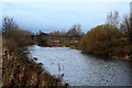
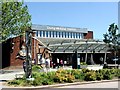
Residents of DE1 2RS have access to a range of amenities within practical reach. Nearby rail stations such as Derby, Peartree, and Spondon offer convenient travel options, while retail outlets like Tesco, M&S, and Sainsburys provide everyday shopping needs. The area’s proximity to Derby’s historic Derby Arboretum—a Grade II* listed park—offers green space for leisure, walking, and recreation. This park, established in 1840, is a focal point for the local community, with landscaped gardens, ponds, and open playing fields. The blend of urban convenience and natural space creates a balanced lifestyle, supporting both daily errands and relaxation. While the area lacks large-scale entertainment venues, its connection to Derby’s broader amenities ensures residents can access cultural and social opportunities in the city centre.
Amenities
Schools
Near DE1 2RS are Beechwood Nursery School, a nursery, and St James’ Church of England Aided Junior School, which operates as both a primary school and an academy with a Good Ofsted rating. The presence of a nursery and a primary school suggests that families with young children have access to early education and primary schooling within the area. The academy’s Good rating indicates a school that meets national standards for teaching quality and student outcomes. However, the absence of secondary schools nearby means students may need to commute to other parts of Derby for further education. This mix of school types offers a practical solution for early years and primary education but requires planning for secondary schooling.
| Rank | School | Type | Entry gender | Ages |
|---|
Explore more schools in this area
Go to Schools tabDemographics
The population of DE1 2RS is predominantly adults aged 30–64, with a median age of 47. This suggests a mature, stable community, likely with established careers and families. Home ownership is low at 19%, indicating that most residents rent their properties. The accommodation type is primarily flats, which is typical for smaller urban areas with limited space for larger homes. The predominant ethnic group is White, reflecting broader demographic trends in Derby. While no specific data on deprivation is provided, the low home ownership rate may suggest a reliance on rental markets or shared housing. The age profile implies a community focused on long-term stability, with fewer young families or students compared to other areas. This demographic structure shapes the area’s social dynamics, with a focus on intergenerational living and community cohesion.
Household Size
Accommodation Type
Tenure
Ethnic Group
Religion
Household Composition
Age
Household Deprivation
NS-SEC
Explore more demographic insights in this area
Go to Demographics tabPlanning
Planning Constraints
- Flood RiskPremium
- Ramsar Wetland SitesPremium
- Area of Outstanding Natural BeautyPremium
- Protected Nature ReservePremium
- Protected WoodlandPremium