Area Overview for DE1 1XH
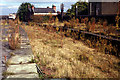
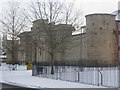
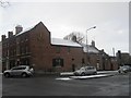
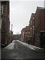
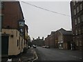
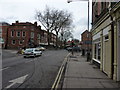
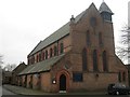
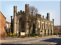
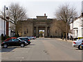
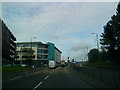
Photos of DE1 1XH


Area Information
DE1 1XH is a small residential postcode cluster in Derby, England, nestled along the River Derwent. With a population of 1,578, it is part of Darley Ward, a district with deep historical roots. The area became part of Derby in 1968 and is closely tied to the Derwent Valley Mills World Heritage Site, reflecting its 18th-century industrial past. Once home to the Evans family’s Boar’s Head Mills, the village was built around cotton and thread production, with terraced housing like Flat Square and Brick Row dating back to the late 1700s. Today, the area blends historical architecture with modern living, offering proximity to Derby’s rail network and retail hubs. Residents benefit from easy access to Derby Railway Station and nearby shops, including Asda and Lidl. While the community is small, it sits at the intersection of heritage and contemporary infrastructure, making it a unique spot for those seeking a mix of history and practicality in the East Midlands.
- Area Type
- Postcode
- Area Size
- Not available
- Population
- Not available
- Population Density
- Not available
The property market in DE1 1XH is overwhelmingly rental-focused, with just 7% of homes owned by residents. The accommodation type is exclusively flats, a legacy of the 18th-century industrial housing built for mill workers. This small postcode cluster, part of Derby’s Darley Ward, has limited housing stock, which may drive competition among renters. The flat-dominated market suggests a lack of larger family homes, making it more suited to single occupants or small households. Buyers considering the area should note that property ownership is rare here, and any purchases would likely be for investment rather than long-term residence. The historical terraced housing, such as Flat Square, adds character but may not meet modern family needs. Those seeking owner-occupied properties may need to look beyond the immediate postcode.
House Prices in DE1 1XH
No properties found in this postcode.
Energy Efficiency in DE1 1XH
Living in DE1 1XH offers access to nearby retail options such as Asda Derby, Sainsburys Nuns, and Lidl Uttoxeter, all within practical reach. The area’s rail connections provide easy access to Derby’s city centre and beyond, though the postcode itself has minimal local amenities. The River Derwent, a historical feature of the area, may offer recreational opportunities, though no parks or leisure facilities are listed in the data. The presence of 5 retail outlets and 5 rail stations indicates a focus on practicality over luxury, making it convenient for daily errands and commuting. However, residents seeking a more vibrant lifestyle may need to venture further afield for dining, entertainment, or cultural attractions.
Amenities
Schools
The nearest school to DE1 1XH is Rathbone Training – Derby Centre, an independent institution. No other schools are listed in the data, meaning families in this area have limited options for state education. Rathbone Training, as an independent school, likely offers specialist programs or smaller class sizes, though its Ofsted rating is not specified. The absence of other schools suggests that parents may need to look beyond the immediate vicinity for additional educational choices. This could be a consideration for families prioritizing a range of school types or seeking proximity to a broader network of educational institutions.
| Rank | School | Type | Entry gender | Ages |
|---|
Explore more schools in this area
Go to Schools tabDemographics
DE1 1XH has a median age of 22, with the majority of residents aged 15–29. This reflects a young, dynamic population, likely drawn to the area’s proximity to Derby’s employment and educational opportunities. Home ownership is exceptionally low at 7%, indicating that most residents are renters, which shapes the community’s transient character. The accommodation type is predominantly flats, a legacy of the 18th-century industrial housing built for mill workers. The predominant ethnic group is White, though no specific diversity metrics are provided. The low home ownership rate and young demographic suggest a community focused on short-term living, possibly influenced by student or workforce mobility. This profile may appeal to those seeking affordable rental options but could also mean a lack of long-term stability in local services or social networks.
Household Size
Accommodation Type
Tenure
Ethnic Group
Religion
Household Composition
Age
Household Deprivation
NS-SEC
Explore more demographic insights in this area
Go to Demographics tabPlanning
Planning Constraints
- Flood RiskPremium
- Ramsar Wetland SitesPremium
- Area of Outstanding Natural BeautyPremium
- Protected Nature ReservePremium
- Protected WoodlandPremium