Area Overview for DE1 1SY
Photos of DE1 1SY

Area Information
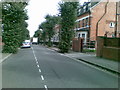
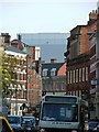
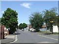
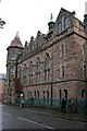
DE1 1SY is a small residential postcode cluster in Derby, England, home to 1,578 people. It sits near the Derby Arboretum, a historic park established in 1840 and gifted by Joseph Strutt, a local philanthropist. This area is defined by its compact nature, with a focus on proximity to green spaces and urban infrastructure. Daily life here is shaped by its proximity to Derby city centre, just a mile north, and its integration with the Arboretum’s recreational offerings. The area’s character is influenced by its history as a planned urban park, which continues to serve as a focal point for residents. With a population skewed toward young adults aged 15–29, the community reflects a dynamic, possibly transient demographic. Living here means balancing access to city amenities with the quietude of a park-centric environment. The postcode’s small size means it is tightly woven into Derby’s broader urban fabric, with no major natural or planning constraints affecting its development.
- Area Type
- Postcode
- Area Size
- Not available
- Population
- Not available
- Population Density
- Not available
DE1 1SY is not a high home-ownership area, with only 7% of properties owned by residents. The accommodation type is predominantly flats, indicating a rental market dominated by purpose-built or converted units. This suggests that the area is more suited to renters than buyers, particularly those seeking short-term or flexible housing. The small postcode area means property choices are limited, with little scope for owner-occupied homes or larger family dwellings. For buyers, this area may present challenges in finding available properties, as the market is likely competitive and skewed toward leaseholds. The flat-dominated stock also implies limited scope for property value growth, as flats in urban areas often have lower capital appreciation compared to detached or semi-detached homes.
House Prices in DE1 1SY
No properties found in this postcode.
Energy Efficiency in DE1 1SY
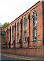
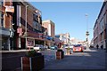
Residents of DE1 1SY have access to a range of nearby amenities, including five retail outlets such as Tesco Derby St, Iceland Albion, and Sainsburys Derby. These shops provide essential groceries and everyday items, reducing the need for long trips. The area’s proximity to Derby city centre means additional shopping, dining, and cultural options are within reach. The Derby Arboretum, a Grade II* listed park, offers recreational space with landscaped gardens, ponds, and historic features like a bandstand. This green space is a key asset, providing walking routes, relaxation areas, and community events. The mix of retail, transport, and green space creates a convenient lifestyle, balancing urban accessibility with outdoor leisure.
Amenities
Schools
The nearest school to DE1 1SY is Rathbone Training – Derby Centre, an independent school. No other schools are listed in the data, so this is the only educational institution explicitly referenced. Independent schools typically charge fees and may cater to specific educational philosophies or specialisms. Families seeking state education will need to look beyond the immediate area, as no state schools are mentioned. The presence of an independent school may attract households prioritising private education, though it does not indicate the quality of local state schools. For parents, this suggests a need to research broader Derby-area schools if state education is preferred.
| Rank | School | Type | Entry gender | Ages |
|---|
Explore more schools in this area
Go to Schools tabDemographics
The population of DE1 1SY is predominantly young, with a median age of 22 and the most common age range being 15–29 years. This suggests a community of students, early-career professionals, or those in transient housing. Home ownership is exceptionally low at 7%, indicating that most residents rent their accommodation. The primary housing type is flats, reflecting a high proportion of rental properties in a compact, urban setting. The predominant ethnic group is White, with no data provided on other demographics. The low home ownership rate and young age profile suggest a transient population, possibly linked to student or temporary employment patterns. This demographic structure influences the area’s social dynamics, with a focus on shared spaces and community amenities rather than long-term residential investment.
Household Size
Accommodation Type
Tenure
Ethnic Group
Religion
Household Composition
Age
Household Deprivation
NS-SEC
Explore more demographic insights in this area
Go to Demographics tabPlanning
Planning Constraints
- Flood RiskPremium
- Ramsar Wetland SitesPremium
- Area of Outstanding Natural BeautyPremium
- Protected Nature ReservePremium
- Protected WoodlandPremium