Area Overview for DE1 1RH
Photos of DE1 1RH

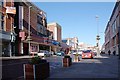
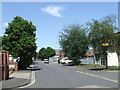

100 photos from this area
Area Information
Key information about the DE1 1RH including its size, population, and administrative classification.
- Area Type
- Postcode
- Area Size
- 3556 m²
- Population
- Not available
- Population Density
- Not available
House Prices in DE1 1RH
51
Properties
£93,218
Average Sold Price
£65,000
Lowest Price
£120,000
Highest Price
Showing 51 properties
| Address | Type | Beds | Baths | Last Sale Price | Last Sale Date | |
|---|---|---|---|---|---|---|
| 18, Babington Court, Gower Street, Derby, DE1 1RH | Flat | - | - | £76,000 | Apr 2024 | |
| 2, Babington Court, Gower Street, Derby, DE1 1RH | Flat | - | - | £80,000 | Feb 2024 | |
| 44, Babington Court, Gower Street, Derby, DE1 1RH | Maisonette | - | - | £110,000 | Aug 2023 | |
| 43, Babington Court, Gower Street, Derby, DE1 1RH | Flat | - | - | £82,000 | Aug 2023 | |
| 33, Babington Court, Gower Street, Derby, DE1 1RH | Flat | 2 | 1 | £65,000 | Jun 2023 | |
| 9, Babington Court, Gower Street, Derby, DE1 1RH | Flat | 2 | 1 | £87,500 | Jul 2022 | |
| 32, Babington Court, Gower Street, Derby, DE1 1RH | Flat | - | - | £75,500 | Aug 2014 | |
| 4, Babington Court, Gower Street, Derby, DE1 1RH | Flat | - | - | £97,500 | Jun 2007 | |
| 11, Babington Court, Gower Street, Derby, DE1 1RH | Flat | 1 | 1 | £96,500 | May 2007 | |
| 16, Babington Court, Gower Street, Derby, DE1 1RH | Flat | 2 | 2 | £115,000 | May 2007 |
Page 1 of 6
Energy Efficiency in DE1 1RH
Amenities
Schools
| Rank | School | Type | Entry gender | Ages |
|---|
Explore more schools in this area
Go to Schools tabDemographics
Household Size
One person
most common
Accommodation Type
Flats
most common
Tenure
7
majority
Ethnic Group
White
most common
Religion
N/A
most common
Household Composition
N/A
most common
Age
22
median
Young Adults (15-29 years)
most common
Household Deprivation
N/A
with no deprivation
NS-SEC
20
in Lower managerial occupations
Explore more demographic insights in this area
Go to Demographics tabPlanning
Planning Constraints
- Flood RiskPremium
- Ramsar Wetland SitesPremium
- Area of Outstanding Natural BeautyPremium
- Protected Nature ReservePremium
- Protected WoodlandPremium