Area Overview for DE1 1BS
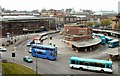
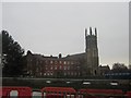
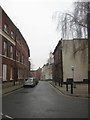
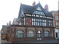
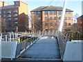
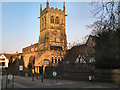
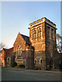
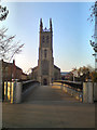
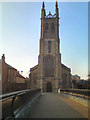
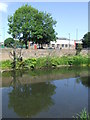
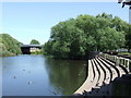
Photos of DE1 1BS

Area Information
Living in DE1 1BS means residing in a compact, historically rich postcode within Derby’s Darley Ward. This small residential cluster, covering 1,317 square metres, is part of the Derwent Valley Mills World Heritage Site, a legacy of 18th-century industrial innovation. The area’s population of 1,578 people is densely packed, with 119,824 residents per square kilometre, reflecting its urban character. Historically, it was shaped by the Evans family’s Boar’s Head Mills, which created a planned village with terraced housing like Flat Square and Brick Row. Today, the area retains echoes of its industrial past while serving as a modern residential hub. Its proximity to the River Derwent and the heritage site offers a blend of historical depth and contemporary living. For residents, daily life is defined by proximity to retail, rail networks, and the city’s infrastructure, though the high population density means the area feels both lively and tightly knit.
- Area Type
- Postcode
- Area Size
- 1317 m²
- Population
- Not available
- Population Density
- Not available
The property market in DE1 1BS is overwhelmingly rental-focused, with only 7% of residents owning their homes. The accommodation type is predominantly flats, a reflection of the area’s high population density and compact layout. This suggests a limited stock of owner-occupied properties, making the market more suited to renters than buyers seeking long-term investment. The small area size and proximity to Derby’s rail network may appeal to those prioritising convenience over space. However, the high population density and lack of larger housing types indicate that the immediate surroundings offer few alternatives for those seeking detached homes or larger properties.
House Prices in DE1 1BS
No properties found in this postcode.
Energy Efficiency in DE1 1BS
The lifestyle in DE1 1BS is shaped by its proximity to retail and rail hubs. Nearby amenities include Tesco Derby St, Lidl Uttoxeter, and Iceland Albion, offering everyday shopping convenience. The rail network, with stations like Derby and Spondon, connects residents to broader transport routes. While the area lacks detailed information on parks or leisure facilities, its compact size and urban setting suggest a focus on accessibility over expansive green spaces. The presence of retail outlets and rail links contributes to a practical, efficient lifestyle, ideal for those prioritising convenience.
Amenities
Schools
The nearest school to DE1 1BS is Rathbone Training – Derby Centre, an independent institution. Independent schools typically charge fees and may offer specialised curricula or smaller class sizes. While the data does not provide Ofsted ratings, the presence of a single school suggests a limited range of educational options. Families seeking state-funded education may need to look further afield, as no other schools are listed in the area. The school’s type and location could influence decisions for parents prioritising specific educational environments.
| Rank | School | Type | Entry gender | Ages |
|---|
Explore more schools in this area
Go to Schools tabDemographics
DE1 1BS has a median age of 22, with the majority of residents aged 15–29. This young demographic is reflected in the area’s 7% home ownership rate, indicating that most households are renters rather than owners. The accommodation type is predominantly flats, a common feature in high-density urban areas. The predominant ethnic group is White, though specific data on diversity beyond this is not provided. The high population density—119,824 people per square kilometre—suggests a compact, possibly transient community. For quality of life, the low home ownership rate may impact long-term stability, while the young age profile could influence local amenities and services.
Household Size
Accommodation Type
Tenure
Ethnic Group
Religion
Household Composition
Age
Household Deprivation
NS-SEC
Explore more demographic insights in this area
Go to Demographics tabPlanning
Planning Constraints
- Flood RiskPremium
- Ramsar Wetland SitesPremium
- Area of Outstanding Natural BeautyPremium
- Protected Nature ReservePremium
- Protected WoodlandPremium