Area Overview for Darley Dale
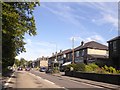
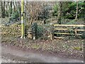
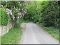
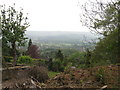
Photos of Darley Dale
Area Information
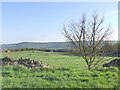
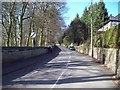
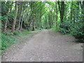
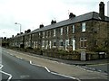
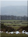
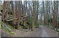
Darley Dale is a built-up area covering 1.9 square kilometres in Derbyshire. It functions as a distinct town within a larger county context, offering a contained environment for residents. The location sits within the Peak District fringe, providing direct access to the countryside while maintaining defined urban boundaries. Living in Darley Dale means existing within a compact footprint where daily needs are largely reachable without long commutes. The area attracts those seeking a settled lifestyle away from major industrial hubs like Derby or Stoke-on-Trent, yet still close enough to access county towns such as Matlock. The character of this neighbourhood is shaped by its size and position, creating a sense of enclosure that many find comforting. You are part of a community that has developed organically over decades, supported by local institutions and transport links. The area is not a sprawling metropolis but a focused settlement where residents know their surroundings intimately. This concentration of population allows for efficient local services and a tight-knit social fabric. When you consider homes in Darley Dale, you buy into a specific place with clear limits and strong local identity. The town offers a grounded experience suitable for families and retirees alike, balancing proximity to nature with the convenience of established town centre facilities.
- Area Type
- Built Up Area 250
- Area Size
- 1.9 km²
- Population
- Not available
- Population Density
- Not available
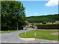
Daily life in Darley Dale is supported by a compact network of amenities situated within walking or short driving distance. Residents have access to five major retail outlets, including Co-op Darley, Spar, and Sainsburys Matlock. These supermarkets and high street stores form the backbone of local commerce, allowing you to handle groceries, household essentials, and weekly shopping needs without travelling far. Beyond retail, the area is served by three metro stops: Darley Dale, Rowsley South, and Wirksworth. These stations connect the town to surrounding interests and often serve as gateways to country walks and local attractions. Rail connections via Matlock Railway Station, Matlock Bath Railway Station, and Cromford Railway Station further extend your travel range for leisure or business. The combination of these transport options means that you can visit nearby villages by train or access broader regional hubs by car and rail. Dining, pubs, and small local shops supplement the larger stores, creating a self-sufficient environment for the 1.9 square kilometre zone. You do not need a vehicle for every outing, though one is helpful for reaching the nearest train station if your home is not immediately adjacent to transport links. The convenience of these nearby amenities reduces the friction of daily errands and supports a lifestyle where local services meet most immediate needs.
Amenities
Schools
Education provision in Darley Dale is centred on primary education, with three specific schools serving the immediate community. Darley Dale Primary School holds a good Ofsted rating and serves as the central educational hub for the area. Darley Churchtown CofE Primary School operates within the same catchment network, also holding a good Ofsted rating. A third option, Darley Churchtown Church of England Primary School, completes the trio of provision available to local families. The presence of two schools with confirmed good ratings provides a reliable educational base for children growing up in the neighbourhood. However, the data indicates that not all schools in the immediate vicinity have published Ofsted ratings in the current dataset, so families with older children may need to plan ahead for secondary education outside the immediate area. The mix is entirely primary-focused, meaning there are no comprehensive or high schools physically located within Darley Dale. You must look beyond the town limits for post-primary options, which usually involve travel to Matlock or nearby towns. For families, this means early schooling is convenient but later education requires commuting. The local schools offer a traditional setting that integrates well with the rural character of the area, providing a safe and familiar environment for younger residents.
| Rank | School | Type | Entry gender | Ages |
|---|
Explore more schools in this area
Go to Schools tabDemographics
The community in Darley Dale presents a clear demographic profile defined by its older population structure. The median age of residents is 70 years, indicating that the majority of the population falls within the later stages of adult life or retirement age. This age distribution shapes the daily rhythm of the neighbourhood and influences the demand for certain local services. Home ownership stands at 74%, which reflects a stable population where long-term residents have secured their residency rather than cycling through short-term tenancies. This high rate of ownership is typical of areas favoured by retirees and those seeking permanent, self-managed accommodation. Household composition data confirms the total population structure, supporting the view of a settled community rather than a transient workforce district. Accommodation types reflect this need for stability, with many properties designed as single-family homes or converted cottages suitable for independent living. While specific ethnic group and religious affiliation data are not detailed in current records, the area maintains a predominantly established character. The absence of rapid demographic shifts suggests a low-pressure environment where neighbours often know each other personally. You can expect a quiet atmosphere where life moves at a pace dictated by seasons and personal rhythms rather than corporate schedules. This demographic reality means that care services and leisure facilities for older adults will be more prominent than nightlife or youth-oriented recreation centres.
Household Size
Accommodation Type
Tenure
Ethnic Group
Religion
Household Composition
Age
Household Deprivation
NS-SEC
Explore more demographic insights in this area
Go to Demographics tabPlanning
Planning Constraints
- Crime RiskPremium