Area Overview for CV23 8UJ
Photos of CV23 8UJ
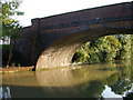
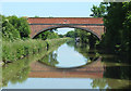
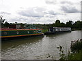
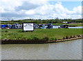
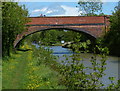
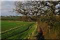
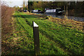
33 photos from this area
Area Information
Key information about the CV23 8UJ including its size, population, and administrative classification.
- Area Type
- Postcode
- Area Size
- 21.0 hectares
- Population
- 2290
- Population Density
- 184 people/km²
House Prices in CV23 8UJ
13
Properties
-
Average Sold Price
-
Lowest Price
-
Highest Price
Showing 13 properties
| Address | Type | Beds | Baths | Last Sale Price | Last Sale Date | |
|---|---|---|---|---|---|---|
| Accommodation, Grove Farm, Daventry Road, Ashby St Ledgers, CV23 8UJ | Detached | - | - | - | - | |
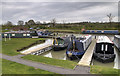
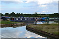
| Old Oak Farm Fishery, Barby Lane, Barby, CV23 8UJ | Farm | - | - | - | - | |
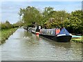
| Nb Canterbury Pearl, Barby Moorings, Barby Lane, Barby, CV23 8UJ | Houseboat | - | - | - | - | |
| Nb Trade Winds 2, Barby Moorings, Barby Lane, Barby, CV23 8UJ | Houseboat | - | - | - | - | |
| Oak Tree Farm, Barby Lane, Barby, CV23 8UJ | Farm | - | - | - | - | |
| Nb Bascote, Barby Moorings, Barby Lane, Barby, CV23 8UJ | Houseboat | - | - | - | - | |
| Nb Albert, Barby Moorings, Barby Lane, Barby, CV23 8UJ | Houseboat | - | - | - | - | |
| Nb Leodien, Barby Moorings, Barby Lane, Barby, CV23 8UJ | Houseboat | - | - | - | - | |
| Nb The Shepherd, Barby Moorings, Barby Lane, Barby, CV23 8UJ | Houseboat | - | - | - | - | |
| Barby Moorings Club House, Barby Lane, Barby, CV23 8UJ | warehouse | - | - | - | - |
Page 1 of 2
Energy Efficiency in CV23 8UJ
Amenities
Schools
| Rank | School | Type | Entry gender | Ages |
|---|
Explore more schools in this area
Go to Schools tabDemographics
Household Size
Two person
most common
Accommodation Type
Houses
most common
Tenure
81
majority
Ethnic Group
White
most common
Religion
N/A
most common
Household Composition
N/A
most common
Age
47
median
Adults (30-64 years)
most common
Household Deprivation
N/A
with no deprivation
NS-SEC
21
in Lower managerial occupations
Explore more demographic insights in this area
Go to Demographics tabPlanning
Planning Constraints
- Flood RiskPremium
- Ramsar Wetland SitesPremium
- Area of Outstanding Natural BeautyPremium
- Protected Nature ReservePremium
- Protected WoodlandPremium