Area Overview for CV13 6EJ
Photos of CV13 6EJ

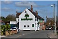
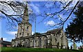

85 photos from this area
Area Information
Key information about the CV13 6EJ including its size, population, and administrative classification.
- Area Type
- Postcode
- Area Size
- 2.2 hectares
- Population
- 2255
- Population Density
- 279 people/km²
House Prices in CV13 6EJ
36
Properties
£206,208
Average Sold Price
£59,000
Lowest Price
£390,000
Highest Price
Showing 36 properties
| Address | Type | Beds | Baths | Last Sale Price | Last Sale Date | |
|---|---|---|---|---|---|---|
| 136 Sherwood Road, Stoke Golding, CV13 6EJ | Semi-detached | 2 | 1 | £207,500 | Jan 2024 | |
| 118 Sherwood Road, Stoke Golding, CV13 6EJ | Bungalow | 4 | 1 | £390,000 | Aug 2023 | |
| 135 Sherwood Road, Stoke Golding, CV13 6EJ | Detached | 3 | 2 | £300,000 | Jun 2023 | |
| 141 Sherwood Road, Stoke Golding, CV13 6EJ | house | 3 | 1 | £308,000 | Nov 2020 | |
| 129 Sherwood Road, Stoke Golding, CV13 6EJ | house | - | - | £327,500 | Oct 2020 | |
| 116 Sherwood Road, Stoke Golding, CV13 6EJ | Bungalow | 4 | 1 | £310,000 | Jul 2019 | |
| 138 Sherwood Road, Stoke Golding, CV13 6EJ | Semi-detached | 3 | 1 | £220,000 | Dec 2017 | |
| 126 Sherwood Road, Stoke Golding, CV13 6EJ | Bungalow | 4 | 2 | £350,000 | Oct 2017 | |
| 111 Sherwood Road, Stoke Golding, CV13 6EJ | Bungalow | 4 | - | £285,000 | Mar 2015 | |
| 122 Sherwood Road, Stoke Golding, CV13 6EJ | Bungalow | 3 | 1 | £223,500 | Jan 2015 |
Page 1 of 4
Energy Efficiency in CV13 6EJ
Amenities
Schools
| Rank | School | Type | Entry gender | Ages |
|---|
Explore more schools in this area
Go to Schools tabDemographics
Household Size
Two person
most common
Accommodation Type
Houses
most common
Tenure
84
majority
Ethnic Group
White
most common
Religion
N/A
most common
Household Composition
N/A
most common
Age
47
median
Adults (30-64 years)
most common
Household Deprivation
N/A
with no deprivation
NS-SEC
41
in Lower managerial occupations
Explore more demographic insights in this area
Go to Demographics tabPlanning
Planning Constraints
- Flood RiskPremium
- Ramsar Wetland SitesPremium
- Area of Outstanding Natural BeautyPremium
- Protected Nature ReservePremium
- Protected WoodlandPremium