Area Overview for CV13 6BD
Photos of CV13 6BD
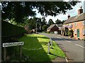
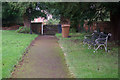


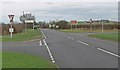
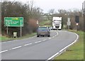
31 photos from this area
Area Information
Key information about the CV13 6BD including its size, population, and administrative classification.
- Area Type
- Postcode
- Area Size
- 6.2 hectares
- Population
- 1368
- Population Density
- 87 people/km²
House Prices in CV13 6BD
42
Properties
£351,416
Average Sold Price
£80,000
Lowest Price
£560,000
Highest Price
Showing 42 properties
| Address | Type | Beds | Baths | Last Sale Price | Last Sale Date | |
|---|---|---|---|---|---|---|
| 18A Old Forge Road, Fenny Drayton, CV13 6BD | Detached | 4 | 3 | £500,000 | Oct 2025 | |
| 20 Old Forge Road, Fenny Drayton, CV13 6BD | Bungalow | 4 | 2 | £560,000 | Mar 2025 | |
| 18 Old Forge Road, Fenny Drayton, CV13 6BD | Detached | 4 | 2 | £465,000 | Mar 2025 | |
| 2 Old Forge Road, Fenny Drayton, CV13 6BD | Bungalow | 3 | 3 | £510,000 | Oct 2024 | |
| 21 Old Forge Road, Fenny Drayton, CV13 6BD | Detached | 4 | 2 | £525,000 | Oct 2020 | |
| Cedar House, 24 Old Forge Road, Fenny Drayton, CV13 6BD | Detached | 4 | 2 | £450,000 | Sep 2020 | |
| 8 Old Forge Road, Fenny Drayton, CV13 6BD | Detached | 5 | 3 | £475,000 | Aug 2017 | |
| Moonrakers, 22 Old Forge Road, Fenny Drayton, CV13 6BD | Detached | 5 | - | £415,000 | May 2017 | |
| 36 Old Forge Road, Fenny Drayton, CV13 6BD | Bungalow | 6 | 3 | £350,000 | Aug 2015 | |
| 26 Old Forge Road, Fenny Drayton, CV13 6BD | Detached | 5 | 2 | £285,000 | Jan 2014 |
Page 1 of 5
Energy Efficiency in CV13 6BD
Amenities
Schools
| Rank | School | Type | Entry gender | Ages |
|---|
Explore more schools in this area
Go to Schools tabDemographics
Household Size
Two person
most common
Accommodation Type
Houses
most common
Tenure
86
majority
Ethnic Group
White
most common
Religion
N/A
most common
Household Composition
N/A
most common
Age
47
median
Adults (30-64 years)
most common
Household Deprivation
N/A
with no deprivation
NS-SEC
40
in Lower managerial occupations
Explore more demographic insights in this area
Go to Demographics tabPlanning
Planning Constraints
- Flood RiskPremium
- Ramsar Wetland SitesPremium
- Area of Outstanding Natural BeautyPremium
- Protected Nature ReservePremium
- Protected WoodlandPremium