Area Overview for CV13 0RG
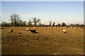
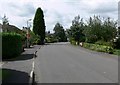
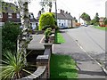
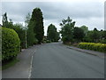
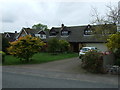
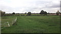
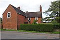
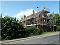
Photos of CV13 0RG
Area Information
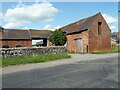
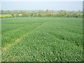
CV13 0RG is a small rural postcode area in Leicestershire, encompassing the village of Carlton. With a population of 2174 and a low density of 78 people per square kilometre, it retains a quiet, historic character. The village is centred around St Andrew’s Church, rebuilt in 1764, and features a single pub, The Gate Hangs Well, which also hosts a café and restaurant. Its rural setting is complemented by local landmarks such as the Leicestershire Round paths and the Diamond Jubilee Orchard. Daily life here is unhurried, with a focus on community and heritage. The area’s proximity to Market Bosworth—just 2.2 miles away—offers access to nearby services without compromising the village’s tranquil atmosphere. For those seeking a small, self-contained community with a strong historical footprint, CV13 0RG provides a distinct alternative to urban living. The mix of traditional architecture, local amenities, and low population density makes it ideal for those prioritising space, history, and a slower pace of life.
- Area Type
- Postcode
- Area Size
- Not available
- Population
- 2174
- Population Density
- 78 people/km²
The property market in CV13 0RG is dominated by owner-occupied homes, with 77% of properties owned by residents rather than rented. This reflects a community prioritising long-term investment over rental income. The accommodation type is exclusively houses, which is typical of rural areas where larger properties are more common. The small population and low density mean the housing stock is limited, making the area less suited to high turnover or speculative investment. For buyers, this implies a stable market with fewer new developments but a focus on maintaining existing properties. The absence of planning constraints such as AONB or protected woodlands allows for greater flexibility in property modifications. However, the small size of the area means buyers must consider proximity to nearby towns like Market Bosworth for additional services.
House Prices in CV13 0RG
No properties found in this postcode.
Energy Efficiency in CV13 0RG
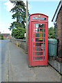
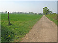
The lifestyle in CV13 0RG is defined by its rural charm and local amenities. Five retail outlets, including the Heart of England Co-operative Co, provide essentials within walking distance, while two railway stations—Shackerstone and Shenton—connect to broader transport networks. The village’s character is enhanced by historical sites like St Andrew’s Church and the Leicestershire Round paths, offering opportunities for walking and leisure. The Gate Hangs Well pub, now a café and restaurant, serves as a social hub. The low population density ensures a peaceful environment, though residents must travel to nearby towns for more extensive services. The mix of traditional shops, green spaces, and historical landmarks creates a self-contained yet connected lifestyle, ideal for those seeking a balance between rural tranquillity and accessibility.
Amenities
Schools
Residents of CV13 0RG have access to three primary schools within practical reach. Congerstone Primary School and St Peter’s Church of England Primary Academy both hold Ofsted ratings of ‘good’, indicating a reliable standard of education. The third, St Peter’s Church of England Primary School, is also a primary institution but lacks an Ofsted rating in the data. The presence of multiple primary schools suggests a family-friendly environment, with options for both state and church-affiliated education. The ‘good’ ratings at two schools provide reassurance for parents seeking quality early education. Given the small size of the area, these schools likely serve a broader regional catchment, making them accessible to nearby communities as well. For families prioritising educational options, the availability of three primary schools within a short distance is a key advantage.
| Rank | School | Type | Entry gender | Ages |
|---|
Explore more schools in this area
Go to Schools tabDemographics
The population of CV13 0RG is predominantly adults aged 30–64, with a median age of 47. This suggests a mature, stable community with a focus on long-term residency. Home ownership is high at 77%, indicating a strong presence of family homes and a low rental market. The area is characterised by houses rather than flats, reflecting its rural nature. The predominant ethnic group is White, which aligns with the broader demographic patterns of the East Midlands region. The low population density and high home ownership rate suggest a community that values privacy and permanence. The absence of specific deprivation data means the area’s quality of life is inferred from its amenities and safety profile. With no significant constraints from protected landscapes or wetlands, residents benefit from a straightforward, unregulated environment for housing and development.
Household Size
Accommodation Type
Tenure
Ethnic Group
Religion
Household Composition
Age
Household Deprivation
NS-SEC
Explore more demographic insights in this area
Go to Demographics tabPlanning
Planning Constraints
- Flood RiskPremium
- Ramsar Wetland SitesPremium
- Area of Outstanding Natural BeautyPremium
- Protected Nature ReservePremium
- Protected WoodlandPremium