Area Overview for CV13 0AH
Photos of CV13 0AH
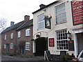
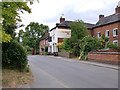
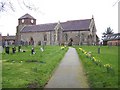
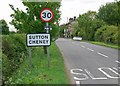
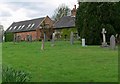
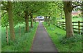
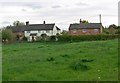
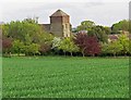
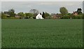
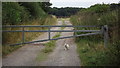
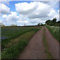
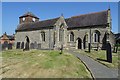
35 photos from this area
Area Information
Key information about the CV13 0AH including its size, population, and administrative classification.
- Area Type
- Postcode
- Area Size
- 48.4 hectares
- Population
- 1507
- Population Density
- 37 people/km²
House Prices in CV13 0AH
11
Properties
£413,000
Average Sold Price
£285,000
Lowest Price
£545,000
Highest Price
Showing 11 properties
| Address | Type | Beds | Baths | Last Sale Price | Last Sale Date | |
|---|---|---|---|---|---|---|
| The Almshouse, Bosworth Road, Sutton Cheney, CV13 0AH | Detached | 7 | 6 | £480,000 | Nov 2019 | |
| Moores Cottage, Bosworth Road, Sutton Cheney, CV13 0AH | Detached | 3 | 2 | £545,000 | Nov 2015 | |
| Glebe Cottage, Bosworth Road, Sutton Cheney, CV13 0AH | Semi-detached | - | - | £425,000 | Jul 2008 | |
| Bumblebee Cottage, Bosworth Road, Sutton Cheney, CV13 0AH | Detached | - | - | £330,000 | May 2007 | |
| Oak Tree Cottage, Bosworth Road, Sutton Cheney, CV13 0AH | Cottage | 4 | 3 | £285,000 | Jun 2001 | |
| Corner Cottage, Bosworth Road, Sutton Cheney, CV13 0AH | house | - | - | - | - | |
| Townsend Farm, Bosworth Road, Sutton Cheney, CV13 0AH | Farm | - | - | - | - | |
| Church Cottage, Bosworth Road, Sutton Cheney, CV13 0AH | Detached | - | - | - | - | |
| Sutton House, Bosworth Road, Sutton Cheney, CV13 0AH | Detached | - | - | - | - | |
| Annexe, The Almshouse, Bosworth Road, Sutton Cheney, CV13 0AH | Cottage | 4 | - | - | - |
Page 1 of 2
Energy Efficiency in CV13 0AH
Amenities
Schools
| Rank | School | Type | Entry gender | Ages |
|---|
Explore more schools in this area
Go to Schools tabDemographics
Household Size
Two person
most common
Accommodation Type
Houses
most common
Tenure
74
majority
Ethnic Group
White
most common
Religion
N/A
most common
Household Composition
N/A
most common
Age
47
median
Adults (30-64 years)
most common
Household Deprivation
N/A
with no deprivation
NS-SEC
40
in Lower managerial occupations
Explore more demographic insights in this area
Go to Demographics tabPlanning
Planning Constraints
- Flood RiskPremium
- Ramsar Wetland SitesPremium
- Area of Outstanding Natural BeautyPremium
- Protected Nature ReservePremium
- Protected WoodlandPremium