Area Overview for Cumberworth
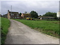
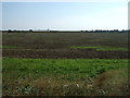
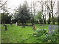
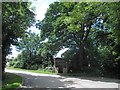
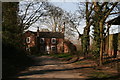
Photos of Cumberworth


Area Information
Cumberworth is a small civil parish located in England, covering a total area of 5.2 km². Living in this community means residing in a settled environment defined by its modest size and long-established character. The area operates as a distinct local unit within the broader administrative landscape, offering a contained but self-contained existence for its inhabitants. You will find that daily life here revolves around the immediate surroundings and established routines typical of rural parishes of this magnitude. The scale of the land, spread across just over five square kilometres, suggests close proximity between homes and local amenities, fostering a compact social fabric. This geographic footprint dictates the pace of life, where distances are short and the local community remains tightly knit. Prospective buyers considering homes in Cumberworth should appreciate the intimacy of such a small footprint, even if it implies limited space for expansion. The area stands as a straightforward example of English rural living, where the boundaries of the parish clearly define the limits of your neighbourhood.
- Area Type
- Parish
- Area Size
- 5.2 km²
- Population
- Not available
- Population Density
- Not available
Demographics
The community profile of Cumberworth indicates a distinctly mature population, with a median age of 70 years. This statistic reflects a settlement where elderly residents form the core demographic, meaning you are almost certainly dealing with a senior-led community upon arrival. The most common age grouping covers the total population, reinforcing the idea that the area lacks a significant young adult or family cohort. Home ownership stands at a robust 78 per cent, demonstrating that the vast majority of households own their property outright or via mortgage. This high rate of ownership points to long-term stability and a lack of transient renting pockets within the parish. The accommodation data shows the total inventory, while household composition records reflect the full span of living arrangements, though these skew heavily towards single occupants or older couples given the age profile. You will not encounter high deprivation levels in this area, as stable ownership and an older demographic usually correlate with financial security. The population lacks significant ethnic diversity drivers in the recorded summary, suggesting a homogeneous, traditional demographic makeup focused on retirement or established residentiary life.
Household Size
Accommodation Type
Tenure
Ethnic Group
Religion
Household Composition
Age
Household Deprivation
NS-SEC
Explore more demographic insights in this area
Go to Demographics tabPlanning
Planning Constraints
- Flood RiskPremium
- Ramsar Wetland SitesPremium
- Area of Outstanding Natural BeautyPremium
- Protected Nature ReservePremium
- Protected WoodlandPremium
- Crime RiskPremium