Area Overview for Crowland and Deeping St. Nicholas Ward
Photos of Crowland and Deeping St. Nicholas Ward
Area Information
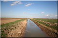
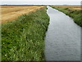
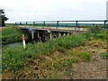
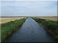
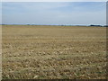
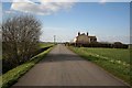
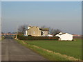
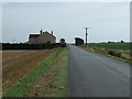
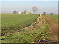
Living in Crowland and Deeping St. Nicholas Ward offers a distinct experience characterised by significant space relative to its population. This district borough unitary ward spans 121.3 square kilometres yet houses just 2,759 residents. You can expect a low-density environment where land is plentiful for the number of people living here. The area covers a vast geographical footprint, creating large distances between properties and local amenities. This layout defines the daily rhythm of life for anyone choosing homes in this specific ward. You will find yourself navigating a landscape that prioritises openness over urban density. The sheer scale of 121.3 km² means that a drive across the ward covers substantial ground. This spaciousness appeals to those who value quiet surroundings over proximity to city centres. However, the low population density of 1842 people per square kilometre also means some services may feel remote compared to larger towns. Recent analyses will show that the ward contains no Ramsar wetland sites or Areas of Outstanding Natural Beauty. While you gain significant privacy and roominess, you must accept that essential facilities are not immediately on your doorstep. The area represents a specific choice for buyers prioritising land over immediate urban convenience.
- Area Type
- District Borough Unitary Ward
- Area Size
- 121.3 km²
- Population
- 2759
- Population Density
- 1842 people/km²
Demographics
The community profile of Crowland and Deeping St. Nicholas Ward is defined by an older population. The median age stands at 70 years, indicating that the majority of residents are seniors. This demographic reality shapes how you might expect the neighbourhood to function day-to-day. You are likely to encounter a community where family units with young children are less common than empty nests or single-occupancy households. Home ownership is a dominant feature of this area, with 74% of households owning their property outright or with a mortgage. This high rate of ownership suggests stability and long-term residents who have settled into the locality. The ward does not reveal specific details regarding household composition breakdowns, but the age profile strongly suggests a shift away from traditional family structures. You should expect an environment tailored more towards retirees than young professionals. With such a high proportion of residents over seventy, local services and social activities probably cater to this specific age bracket. The lack of data on predominant ethnic groups or religious affiliations means you cannot assume high diversity, though an older demographic often correlates with a more homogenous community history. Living here means engaging with a population that has established deep roots in this vast ward.
Household Size
Accommodation Type
Tenure
Ethnic Group
Religion
Household Composition
Age
Household Deprivation
NS-SEC
Explore more demographic insights in this area
Go to Demographics tabPlanning
Planning Constraints
- Flood RiskPremium
- Ramsar Wetland SitesPremium
- Area of Outstanding Natural BeautyPremium
- Protected Nature ReservePremium
- Protected WoodlandPremium
- Crime RiskPremium