Area Overview for Cropwell Ward
Photos of Cropwell Ward
Area Information
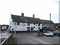
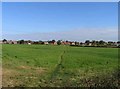
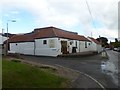
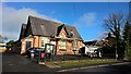
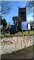
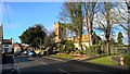
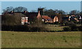
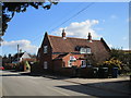
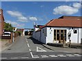
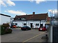
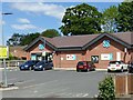
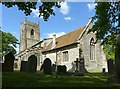
Cropwell Ward is a rural district within Rushcliffe Borough Council in Nottinghamshire, East Midlands. This electoral ward encompasses five distinct villages: Cropwell Bishop, Cropwell Butler, Owthorpe, Tithby and Wiverton Hall. The area covers a geographical size of 26.6 km² and sits on the edge of the Vale of Belvoir, near the border with Leicestershire. You will find the historic core concentrated in Cropwell Bishop, dominated by its prominent church. Modern housing additions from the 1970s and later now sit alongside this historic fabric. The landscape comprises nucleated villages surrounded by open countryside. Hoe Hill offers a wooded hilltop view overlooking the settlement. Home Farm and Manor Farm continue to operate as active agricultural sites. You are located approximately one mile east of the A46, known as the Fosse Way. This Roman road links Newark and Leicester. For those travelling east, the A52 provides access to Grantham and the M1 Junction 24. Living in Cropwell Ward means navigating a location that balances historic preservation with rural daily life. The presence of the disused Grantham Canal adds a wildlife-rich walking route through the countryside.
- Area Type
- District Borough Unitary Ward
- Area Size
- 26.6 km²
- Population
- Not available
- Population Density
- Not available
Demographics
The community in Cropwell Ward displays a clear demographic profile centred on older residents. The median age for the population is 70 years old. This suggests a settlement where many young families have moved elsewhere. You will find that households are likely to be occupied by couples, single elderly persons, or empty nesters. The most common age range statistic reflects this dominance of the senior demographic. Home ownership stands at a very high level of 77 per cent of all residences. This figure indicates that the area is a mature, established community where most people have lived there for decades or own their property outright. Accommodation types vary between the historic village cores and newer developments added in later years. The ethnic composition and religious totals are recorded but do not point to significant recent demographic shifts driven by new migration. You should expect a quiet neighbourhood culture rather than a mix of young professionals and students. This age profile influences local services, shops, and community activities which cater to the needs of an older, settled population.
Household Size
Accommodation Type
Tenure
Ethnic Group
Religion
Household Composition
Age
Household Deprivation
NS-SEC
Explore more demographic insights in this area
Go to Demographics tabPlanning
Planning Constraints
- Flood RiskPremium
- Ramsar Wetland SitesPremium
- Area of Outstanding Natural BeautyPremium
- Protected Nature ReservePremium
- Protected WoodlandPremium
- Crime RiskPremium