Area Overview for Cropston
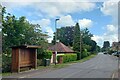
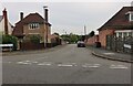
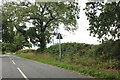
Photos of Cropston


Area Information
Cropston is a compact built-up area in England, spanning 60.7 hectares. It is a town or city with a distinct character shaped by its demographics and infrastructure. The area’s population skews older, with a median age of 70, suggesting a community rooted in long-term residency. Daily life here is defined by proximity to essential services, including five rail stations such as Sileby and Barrow upon Soar, and retail outlets like Budgens Beaumont and Co-op Anstey. The high home ownership rate of 91% indicates a stable, settled population, with most residents living in properties they own. While the area is small, it offers practical connectivity to nearby towns via rail and metro links, including Rothley and Leicester North stations. For those seeking a quieter, well-established environment with accessible amenities, Cropston provides a blend of convenience and community. Its size and infrastructure cater to those prioritising ease of access over sprawling urban sprawl, making it a viable choice for buyers seeking a manageable, mature neighbourhood.
- Area Type
- Built Up Area 250
- Area Size
- 60.7 hectares
- Population
- Not available
- Population Density
- Not available
Cropston offers a practical lifestyle with access to essential amenities within reach. Retail options include Budgens Beaumont, Co-op Anstey, and Iceland Beaumont, providing grocery and convenience shopping. The area is served by five rail stations, including Sileby and Barrow upon Soar, and metro links like Rothley and Leicester North, ensuring connectivity to nearby towns. These transport options make commuting or visiting larger cities feasible. While the data does not mention parks or leisure facilities, the compact size of the area suggests that local green spaces may be limited, though the presence of rail and retail amenities indicates a focus on convenience over expansive recreational areas. The community’s character is defined by its mature demographic and established infrastructure, offering a straightforward, no-frills lifestyle. Residents can expect a quiet, stable environment with easy access to essential services, though those prioritising extensive leisure options may need to look beyond the immediate vicinity.
Amenities
Schools
| Rank | A + A* % | School | Type | Entry gender | Ages |
|---|
Explore more schools in this area
Go to Schools tabDemographics
Cropston’s population is predominantly older, with a median age of 70, reflecting a community where long-term residents outnumber younger demographics. The most common age range is listed as “Age: Total,” which suggests that the data aggregates all age groups but highlights the significant presence of older adults. Home ownership is exceptionally high at 91%, indicating a largely owner-occupied area with limited rental stock. Household composition and accommodation types are noted as “total,” but the data does not specify proportions of single-person households, families, or property types. The predominant ethnic group and religion are also listed as “total,” meaning no breakdown is available. This suggests a homogenous community, though specific diversity metrics are absent. The high home ownership rate implies a stable, low-turnover environment, which may appeal to those seeking long-term residency. However, the lack of detailed demographic breakdowns means potential buyers should consider whether this aligns with their needs for diversity or specific household structures.
Household Size
Accommodation Type
Tenure
Ethnic Group
Religion
Household Composition
Age
Household Deprivation
NS-SEC
Explore more demographic insights in this area
Go to Demographics tabPlanning
Planning Constraints
- Crime RiskLocked