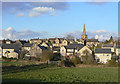
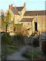
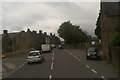
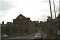
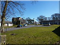
Area Overview for Crich
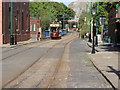
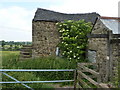
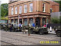
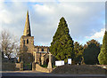
Photos of Crich


Area Information
Crich is a compact built-up area in England, spanning 78.2 hectares. Its character is defined by a mature population, with a median age of 70, suggesting a community rooted in stability and tradition. The area’s proximity to railway stations like Whatstandwell, Ambergate, and Cromford offers easy access to nearby towns, while local amenities such as Budgens Crich and Morrisons Daily provide everyday convenience. For families, Crich’s schools—Crich Junior School and Crich Church of England Infant School—both rated ‘good’ by Ofsted, offer quality primary education. The area’s charm lies in its balance of practicality and quiet living, with a strong emphasis on home ownership, where 78% of residents live in their own homes. This mix of accessible transport, local services, and educational facilities makes Crich a viable choice for those seeking a low-maintenance, community-focused lifestyle.
- Area Type
- Built Up Area 250
- Area Size
- 78.2 hectares
- Population
- Not available
- Population Density
- Not available
Crich’s lifestyle is shaped by its proximity to essential amenities. Local retail options include Budgens Crich, Morrisons Daily, and Co-op Petrol, offering convenience for daily shopping. The area’s rail stations connect to nearby towns, while metro stops at Wirksworth and Idridgehay provide further reach. Though no parks or leisure facilities are listed, the availability of shops and transport suggests a practical, no-frills approach to daily living. The community’s focus on accessibility and simplicity makes it suitable for those prioritising ease of movement over expansive recreational spaces.
Amenities
Schools
Crich offers two primary schools: Crich Junior School and Crich Church of England Infant School, both rated ‘good’ by Ofsted. These institutions provide a range of educational options, with one operating under the Church of England system and the other as a state school. The presence of two primary schools within the area ensures families have nearby choices for early education. While no secondary schools are listed, the proximity to rail links like Whatstandwell Station may facilitate access to larger educational hubs in nearby towns. The ‘good’ Ofsted ratings suggest a standard of teaching and resources that meets or exceeds national benchmarks, which is a key consideration for families prioritising education.
| Rank | A + A* % | School | Type | Entry gender | Ages |
|---|---|---|---|---|---|
| 1 | N/A | Crich Junior School | primary | N/A | N/A |
| 2 | N/A | Crich Church of England Infant School | primary | N/A | N/A |
Explore more schools in this area
Go to Schools tabDemographics
Crich’s population is predominantly older, with a median age of 70, reflecting a community where retired or long-established residents form the majority. Home ownership is high, at 78%, indicating a stable housing market with fewer rental properties. The data does not specify household composition or ethnic diversity, but the ‘total’ figures suggest a broad representation across these categories. The area’s age profile may influence local services, with amenities tailored to older demographics. While no specific deprivation data is available, the high home ownership rate often correlates with lower housing costs and a sense of permanence. This demographic profile shapes a quiet, settled environment, where daily life is likely centred around local shops, transport links, and community institutions.
Household Size
Accommodation Type
Tenure
Ethnic Group
Religion
Household Composition
Age
Household Deprivation
NS-SEC
Explore more demographic insights in this area
Go to Demographics tabPlanning
Planning Constraints
- Crime RiskLocked