Area Overview for Creaton
Photos of Creaton


Area Information
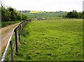
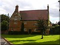
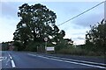
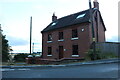
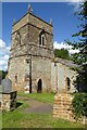
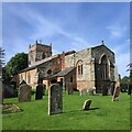
Creaton is a compact built-up area spanning 33.7 hectares, nestled in England. It is a place defined by its older population, with a median age of 70, suggesting a community shaped by long-term residents. Daily life here is likely characterised by a slower pace, with local amenities and transport links playing a central role. The area’s small size means residents can access nearby services without long commutes. While specific details on household composition are not provided, the high home ownership rate of 79% indicates a stable, settled population. Creaton’s proximity to Long Buckby Railway Station and the University Bus Interchange offers practical transport options, connecting residents to broader networks. For those considering living here, the area’s safety score of 83/100 and excellent broadband connectivity suggest a blend of practicality and modern convenience. Whether you’re seeking a quiet retirement or a base for commuting, Creaton’s distinct profile offers a snapshot of a community where familiarity and accessibility coexist.
- Area Type
- Built Up Area 250
- Area Size
- 33.7 hectares
- Population
- Not available
- Population Density
- Not available
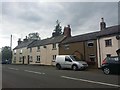
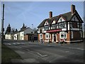
Residents of Creaton have access to a range of nearby amenities, including five retail outlets such as Budgens Seaton, Co-op Brixworth, and Tesco Buckton. These shops provide essential services for daily needs, from groceries to general retail. The University Bus Interchange and Long Buckby Railway Station add practicality, enabling travel to larger centres or educational institutions. While the data does not specify parks or leisure facilities, the presence of multiple retail options and transport links suggests a lifestyle focused on convenience and accessibility. The area’s small footprint means amenities are closely clustered, reducing the need for long journeys. For those valuing proximity to shops and transport, Creaton offers a functional, community-oriented environment.
Amenities
Schools
The nearest school to Creaton is Great Creaton Primary School, a primary institution serving the local community. While no Ofsted rating is provided, the presence of a primary school within reach is a key consideration for families. The absence of secondary schools or other educational institutions in the data means the full range of schooling options is not detailed. However, the existence of a primary school suggests that families with young children can access essential education services locally. For those prioritising proximity to schools, this is a practical advantage, though further research would be needed to assess the school’s performance or capacity.
| Rank | School | Type | Entry gender | Ages |
|---|
Explore more schools in this area
Go to Schools tabDemographics
Creaton’s population skews heavily towards older adults, with a median age of 70. This suggests a community where long-term residents dominate, potentially influencing local culture and social dynamics. Home ownership is high at 79%, indicating a strong presence of owner-occupied properties rather than rental housing. While data on household composition or ethnic diversity is not specified, the figures provided confirm a demographic profile shaped by stability and continuity. The absence of detailed breakdowns on accommodation types or diversity means the area’s full social fabric remains partially unexplored. However, the high home ownership rate implies a community where property is often held long-term, contributing to a sense of permanence. For buyers, this may signal a market where homes are less likely to be short-term investments.
Household Size
Accommodation Type
Tenure
Ethnic Group
Religion
Household Composition
Age
Household Deprivation
NS-SEC
Explore more demographic insights in this area
Go to Demographics tabPlanning
Planning Constraints
- Crime RiskPremium