Area Overview for Cranwell
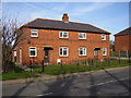
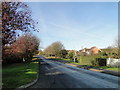
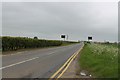
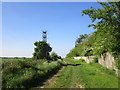
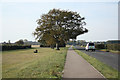
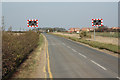
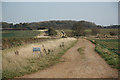
Photos of Cranwell


Area Information
Cranwell stands as a distinct built-up area within Lincolnshire, England, covering a total size of 80.5 hectares. Living in Cranwell means residing in a location defined by its proximity to significant infrastructure rather than traditional city architecture. The community remains local and tight-knit, lacking the density of larger urban centres. You will find yourself in an environment where daily life revolves around a small cluster of homes and essential services. This area does not boast large commercial districts or extensive housing developments. Instead, it operates as a functional residential zone designed for those seeking simplicity over sprawl. The population centre is clearly defined by its physical boundaries, creating a sense of place that does not extend far beyond its perimeter. Daily routines for residents involve travelling to the nearest towns for extended shopping or entertainment, as local options remain limited to practical necessities. The layout supports a quiet existence, but it requires planning for anything beyond basic needs. You spend your days in a concise residential pocket that prioritises stability over excitement.
- Area Type
- Built Up Area 250
- Area Size
- 80.5 hectares
- Population
- Not available
- Population Density
- Not available
Living in Cranwell places you within practical reach of essential amenities, including two airfields, several retail outlets, and four railway stations. The nearest airports are RAF Cranwell and RAF Barkston Heath, offering service access if you require air travel. For daily necessities, you can visit Spar, Lincolnshire Co-operative Co, or Lidl Sleaford to meet your shopping needs. These five retail locations provide a basic range of goods without the extensive selection of larger towns. Transport options are supported by four railway stations, including Rauceby Railway Station, Sleaford Railway Station, and Ancaster Railway Station. Trains to these hubs allow you to leave the area quickly for work or leisure. Leisure facilities are not detailed in the available data, so residents must travel to larger towns for cultural or recreational events. Your lifestyle revolves around these specific, named venues. The convenience is functional rather than expansive; you have the basics and transport links, but you do not have a local entertainment district. You plan your week around trips to Sleaford or Ancaster for broader experiences.
Amenities
Schools
Families looking for education near Cranwell have access to one specific institution with a verified rating. Cranwell Primary School (Foundation) serves as the main educational facility in the vicinity. This school holds an Ofsted rating of good, which is a positive indicator for the quality of education provided to children. The presence of this primary school suggests that young families can access local schooling without travelling to distant towns. There are no secondary schools listed within the immediate data for Cranwell, meaning older children may require transportation to nearby larger towns for secondary education. The mix of school types is narrow, centred entirely on primary education in this specific dataset. This configuration suits young children well but limits choices as students age. You must consider the distance to secondary institutions if you have older children. The good rating of the primary school is a concrete fact supporting the area's suitability for early childhood education.
| Rank | School | Type | Entry gender | Ages |
|---|
Explore more schools in this area
Go to Schools tabDemographics
The community in Cranwell reflects a settled population with a median age of seventy years. This figure indicates that the area attracts and retains older residents who have chosen to stay in their long-term homes. The age profile suggests a household composition typical of retirement cohorts or long-standing families. Home ownership stands at 58 per cent, meaning more than half of the dwellings are owned outright or with a mortgage. The remaining 42 per cent of households are likely rented under various tenures. There is a clear prevalence of established occupants rather than transient workers or young families moving first-time. The diversity of the population is subtle, characterised by this specific demographic concentration. You do not find a mix of age groups across generations living side-by-side in the same blocks. The social fabric is woven from the interests and needs of seniors. Quality of life is shaped by this specific age distribution, focusing on leisure and stability rather than rapid career progression or major lifestyle changes.
Household Size
Accommodation Type
Tenure
Ethnic Group
Religion
Household Composition
Age
Household Deprivation
NS-SEC
Explore more demographic insights in this area
Go to Demographics tabPlanning
Planning Constraints
- Crime RiskPremium