Area Overview for Cranmer Ward
Photos of Cranmer Ward
Area Information
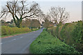
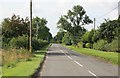
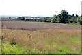
Cranmer Ward is a district within the borough unitary ward of England, spanning a total land area of 39.9 km². The landscape here is defined by its safety profile rather than grand natural features, as the area contains no Ramsar wetland sites, Areas of Outstanding Natural Beauty, or protected nature reserves. You will find that living in Cranmer Ward offers a high degree of personal security, with a crime risk score of 90 out of 100 indicating rates significantly below the average. This statistic reflects a neighbourhood where residents can expect below-average crime levels. The physical footprint of the ward is substantial enough to support a self-contained community, yet it avoids the planning complications often associated with protected woodlands or wetlands. There is no AONB coverage or protected woodland to complicate future local developments or view corridors. Instead, the character of the area is shaped by its demographic composition and established housing stock. You are looking at a space where the primary constraints for property buyers and planners are safety and digital infrastructure, rather than environmental preservation orders.
- Area Type
- District Borough Unitary Ward
- Area Size
- 39.9 km²
- Population
- Not available
- Population Density
- Not available
Demographics
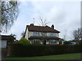
The community in Cranmer Ward is exceptionally mature, with a median age of 70 years. This figure places the resident population firmly within the older demographic brackets compared to the national average. You are entering a neighbourhood where the majority of occupants are retirees or older adults rather than young families seeking to raise children. Home ownership stands at an impressive 82 per cent, meaning nearly five out of six households have their own properties. This high rate of ownership suggests deep roots and a stable population that is unlikely to relocate frequently. The data shows that accommodation and household composition metrics cover the total population, confirming that these are comprehensive figures for the entire ward. You will not encounter a transient rental culture here; instead, expect to deal with neighbours who have likely lived in their homes for decades. The ethnic and religious diversity data covers the total population but does not specify dominant groups, reflecting a stable, long-term community structure. Living in Cranmer Ward means operating in a setting where the primary activity is often relaxation, with the highest age range dominating the social scene.
Household Size
Accommodation Type
Tenure
Ethnic Group
Religion
Household Composition
Age
Household Deprivation
NS-SEC
Explore more demographic insights in this area
Go to Demographics tabPlanning
Planning Constraints
- Flood RiskPremium
- Ramsar Wetland SitesPremium
- Area of Outstanding Natural BeautyPremium
- Protected Nature ReservePremium
- Protected WoodlandPremium
- Crime RiskPremium