Area Overview for Cranford
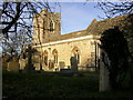
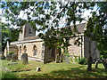
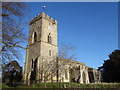
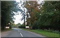
Photos of Cranford

Area Information
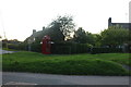
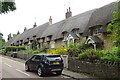
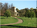
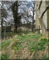
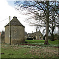
Cranford occupies a defined footprint of 9.6 square kilometres within the Greater London area. It operates as a civil parish, a local administrative unit that offers residents a distinct sense of community governance. Properties in Cranford cater to those seeking a specific residential setting rather than the density found in central boroughs. The area provides a settled environment where daily life revolves around local amenities and a stable neighbourhood dynamic. Living in Cranford often means navigating a compact territory where the boundaries of the parish are clearly understood by long-term residents. Buyers looking at homes in Cranford are entering a market characterised by established housing stock. The location functions as a residential hub with practical access to surrounding transport links. Daily routines here typically involve short commutes or reliance on the extensive digital infrastructure that supports remote working. This parish offers a straightforward proposition for those who prioritise clear geographic limits and a non-metropolitan feel within the London perimeter. The character of the area remains firmly rooted in its status as a designated civil parish rather than a sprawling urban zone.
- Area Type
- Parish
- Area Size
- 9.6 km²
- Population
- Not available
- Population Density
- Not available
Demographics
The community profile within Cranford shows that 68% of residents own their homes outright. This high level of home ownership suggests a stable population with deep local roots. The demographic data indicates that the median age for individuals in Cranford is 70 years old. This figure points to a resident base that skews significantly towards older adults. Most households reflect this concentration, with age data confirming a mature population structure. Accommodation types and household composition align with this older demographic profile, indicating that properties in the area are likely suited to established families or retired individuals. There are no indications of a young professional influx or a high volume of student housing based on the available age metrics. The absence of younger age brackets means the social vibrancy of Cranford is driven by an older cohort. This statistical picture clarifies who you will encounter when walking around homes in Cranford. You are entering a community where the age range is predominantly senior, which influences the pace of life and local social activities. Understanding these figures helps you gauge whether the area fits your lifestyle requirements regarding companionship and community interaction.
Household Size
Accommodation Type
Tenure
Ethnic Group
Religion
Household Composition
Age
Household Deprivation
NS-SEC
Explore more demographic insights in this area
Go to Demographics tabPlanning
Planning Constraints
- Flood RiskPremium
- Ramsar Wetland SitesPremium
- Area of Outstanding Natural BeautyPremium
- Protected Nature ReservePremium
- Protected WoodlandPremium
- Crime RiskPremium