Area Overview for Counthorpe and Creeton
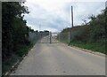
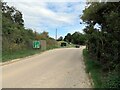
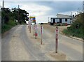
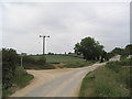
Photos of Counthorpe and Creeton
Area Information
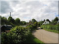
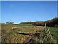
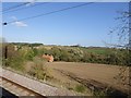
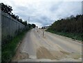
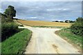
Living in Counthorpe and Creeton means settling into a quiet civil parish in England where a strong sense of community remains central to daily life. This small geographical area covers just 8.9 km², creating a compact environment where residents know their neighbours. The parish operates as a distinct local unit within the wider county structure, offering a defined space for local governance and community organisation. You will find a setting that prioritizes local interaction over urban density, providing a retreat from larger towns while maintaining essential connections. The demographic profile suggests a neighbourhood where residents have established deep roots in the locality. With a specific population spread across this relatively small footprint, everyday life revolves around familiarity rather than anonymity. The area functions as a self-contained community where local institutions and routines dictate the pace of life. Prospective buyers should understand that choosing Counthorpe and Creeton means selecting a lifestyle defined by its modest size and established character. This parish offers a straightforward environment for those seeking stability. The compact nature of the 8.9 km² landmass ensures that travel distances within the parish are short, facilitating easy access to local amenities and social hubs. You are looking at a location where the boundary between the immediate neighbourhood and the surrounding region is clear. The area represents a practical choice for individuals who value a defined locality with predictable community dynamics.
- Area Type
- Parish
- Area Size
- 8.9 km²
- Population
- Not available
- Population Density
- Not available
Demographics
The community in Counthorpe and Creeton is defined by a distinct age profile that skews significantly towards older residents. The median age stands at 70, indicating that half of the population is over this threshold. This demographic reality shapes the social fabric of the parish, where local services and community activities cater primarily to retirees and senior citizens. When considering homes in Counthorpe and Creeton, you must recognise that the neighbourhood has a mature character driven by long-term residents. Home ownership is the dominant form of residence within this area, with 82% of homes owned by their occupants. This high figure suggests widespread financial independence among locals and a long-term commitment to the parish. The remaining 18% of households consist primarily of renters, reflecting a market where ownership is the established norm rather than the exception. This statistic influences the cost and availability of property transactions significantly. Accommodation types and household compositions reflect a settled population structure typical of rural parishes with older demographics. The diversity within Counthorpe and Creeton, while present, operates within the context of these established patterns. Families with young children are less common than in urban centres, while established households form the core of the social network. Understanding this composition helps you anticipate the kind of neighbourly interactions and local events you might expect. The 82% ownership rate confirms that this is a stable, owner-occupied community.
Household Size
Accommodation Type
Tenure
Ethnic Group
Religion
Household Composition
Age
Household Deprivation
NS-SEC
Explore more demographic insights in this area
Go to Demographics tabPlanning
Planning Constraints
- Flood RiskLocked
- Ramsar Wetland SitesLocked
- Area of Outstanding Natural BeautyLocked
- Protected Nature ReserveLocked
- Protected WoodlandLocked
- Crime RiskLocked