Area Overview for Cotes
Photos of Cotes


Area Information
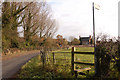
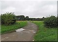
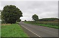
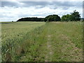
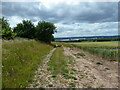
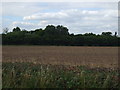
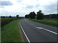
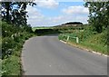
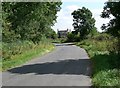
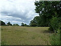
Cotes sits as a small civil parish just outside Loughborough within the Charnwood district of Leicestershire. This hamlet forms part of the larger Burton on the Wolds, Cotes and Prestwold parish and covers a compact area of just 3.0 km². The location places you on the River Soar, with Cotes Bridge serving as the primary crossing point for the A60 trunk road. This major road links the village directly to Nottingham and Loughborough, ensuring straightforward access to wider transport networks. History runs deep here, with the name deriving from Old English *cot* meaning cottages. A historical battle took place at Cotes Bridge on 18 March 1644 during the First English Civil War, when Royalist forces captured the bridge while en route to relieve Newark. Although the medieval village was abandoned around 1690, likely due to inclosure acts, the area retains its distinct identity as a residential settlement. The current population stands at approximately 50 residents, creating an intimate community feel within the modern Borough of Leicester. Living in Cotes means you are positioned near the River Soar with direct road connectivity, balancing historical significance with practical accessibility to the East Midlands region. The small scale of the parish ensures a quiet existence close to established transport routes without the bustle of a large town centre.
- Area Type
- Parish
- Area Size
- 3.0 km²
- Population
- Not available
- Population Density
- Not available
Demographics
The community profile of Cotes reflects a static and mature population. The median age is 70, indicating that the area is dominated by older residents rather than young families or professionals. The data indicates that the most common age range covers the total population, meaning the demographic distribution is weighted heavily towards this senior cohort. With a population of about 50 individuals, the social fabric is tightly knit, though specific details on household compositions are not detailed in the available records. You will find that the majority of people in this age group are already settled into their local lives. Home ownership rates stand at 51%, showing a near-even split between owner-occupiers and other tenure types. This figure suggests a mixed market where purchasing a home here is a significant lifestyle step. While the area benefits from a mature social environment, the high median age implies fewer people under 40 and a specific market focus for those downsizing or seeking retirement locations. There is no specific data available regarding the predominant ethnic groups, religious affiliations, or detailed breakdowns of household structures. The lack of younger demographics means the local vibe remains tranquil, characterised by residents who have lived in the parish for many years. Living in Cotes involves integrating into a community where the typical resident is an older adult, well-established in the local geography and history.
Household Size
Accommodation Type
Tenure
Ethnic Group
Religion
Household Composition
Age
Household Deprivation
NS-SEC
Explore more demographic insights in this area
Go to Demographics tabPlanning
Planning Constraints
- Flood RiskPremium
- Ramsar Wetland SitesPremium
- Area of Outstanding Natural BeautyPremium
- Protected Nature ReservePremium
- Protected WoodlandPremium
- Crime RiskPremium