Area Overview for Cote Heath Ward
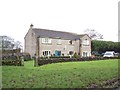
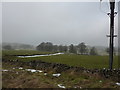
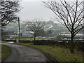
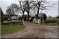
Photos of Cote Heath Ward


Area Information
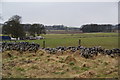
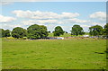
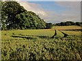
Living in Cote Heath Ward offers a distinct experience within Solihull, defined by its modest footprint and quiet character. The area covers just 8.9 km², creating a compact neighbourhood where residents know one another's rhythms. You will find this to be a settled environment rather than a rapidly developing hub, with no signs of sprawling expansion currently affecting the daily pace. The ward sits in a specific district borough context where community ties tend to be tighter due to the smaller overall size. Daily life here moves at a slower tempo compared to larger population centres, which suits those seeking a retreat from urban density. The landscape is managed carefully, though residents must navigate planning constraints related to protected natural spaces within these boundaries. Your journey through the area reveals a place where nature and residential stability coexist without intense competition for space. Cote Heath Ward remains a consistent choice for buyers who prioritise tranquility over proximity to major commercial districts. The lack of large-scale planning restrictions in some areas does not mean the landscape is untouched; instead, it indicates a managed integration of green spaces into the residential layout. When you settle in Cote Heath Ward, you join a community where the environment is quietly preserved alongside established homes. This balance creates a living environment that feels both contained and respectful of its surroundings. The area's size ensures that travel distances are short, but the specific layout of roads and parks defines the rhythm of your week.
- Area Type
- District Borough Unitary Ward
- Area Size
- 8.9 km²
- Population
- Not available
- Population Density
- Not available
Demographics
The community within Cote Heath Ward is shaped by a distinct age profile that sets it apart from many other local neighbourhoods. You will encounter a population with a median age of 70, indicating that a significant portion of residents are senior citizens. This demographic reality influences the local culture, with services and amenities likely catering to an older demographic. Home ownership stands at a firm 74%, proving that the majority of households own their properties outright or with a mortgage. This high level of ownership suggests long-term residents who have put down roots rather than transient occupants looking for temporary accommodation. The household composition reflects this stability, with families and individuals settling in for the long haul rather than cycling through the market. While specific figures on ethnicity and religion are not detailed in the current census snapshot, the area maintains a cohesive community structure driven by its age profile. The low turnover rate associated with older populations means that local traditions and neighbourly connections remain strong over decades. Living in Cote Heath Ward means engaging with a demographic where experience and stability are the prevailing themes. This age group often values convenience and community support, shaping local interactions and social dynamics. The demographic makeup creates a predictable environment where you are likely to meet peers with similar life stages and priorities. Housing stocks in Cote Heath Ward reflect this, often favouring layouts and sizes suitable for established households rather than young families or students.
Household Size
Accommodation Type
Tenure
Ethnic Group
Religion
Household Composition
Age
Household Deprivation
NS-SEC
Explore more demographic insights in this area
Go to Demographics tabPlanning
Planning Constraints
- Flood RiskPremium
- Ramsar Wetland SitesPremium
- Area of Outstanding Natural BeautyPremium
- Protected Nature ReservePremium
- Protected WoodlandPremium
- Crime RiskPremium