Area Overview for Corby West Ward
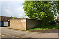
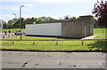
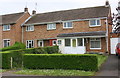
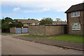
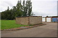
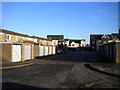
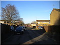
Photos of Corby West Ward
Area Information
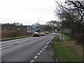
Living in Corby West Ward offers residents a defined slice of the town situated within the unitary authority of North Northamptonshire. This ward occupies just 3.2 square kilometres, meaning daily essentials and local points of interest remain very close to hand. Corby itself is located 23 miles northeast of Northampton, placing residents in a civil parish approximately 6 miles from the A14 at Kettering. The area forms part of a broader network of transport routes including the A43, A427 and A6003, with dual carriageways creating an outer ring around the town. You will find the ward is roughly two hours from major airports in Birmingham, Luton, Stansted and East Midlands. For those considering homes in Corby West Ward, the compact nature of the area suggests a convenient lifestyle where the outside world is accessible yet the local environment is not lost. The town coordinates sit at approximately 52.49°N, 0.72°W, establishing its fixed position in the landscape. Daily life here relies heavily on the existing road infrastructure which connects the ward to regional hubs without the delay of crossing a motorway barrier directly within the ward boundaries. This connectivity ensures you can reach Stansted or East Midlands airports within a standard journey time. The setting allows you to navigate the town efficiently using primary routes like the A427 while maintaining access to the wider county road network.
- Area Type
- District Borough Unitary Ward
- Area Size
- 3.2 km²
- Population
- Not available
- Population Density
- Not available
Demographics
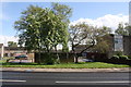
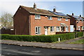
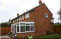
The community within Corby West Ward is characterised by an older population profile. The median age for residents sits at 70 years, indicating a significant concentration of mature households living in the ward. While specific breakdowns by age sub-ranges are not detailed, the central tendency of 70 suggests the area attracts or retains older adults who may value the quiet and stability of established localities. Across the entire ward, home ownership stands at 63 per cent of households. This figure implies that nearly two-thirds of people living in Corby West Ward own their homes outright or with a mortgage, reinforcing the idea of long-term settlement. The ward falls under the broader category of total household composition and total accommodation types, suggesting a diverse mix of living arrangements rather than a single family-centric model. You will find that the ward does not lead the statistical tables for demographic specificity regarding ethnicity or religion, yet the high ownership rate often correlates with more stable, long-standing communities. For prospective buyers, this demographic structure means the neighbourhood may suit those looking for a retirement home or a place for an older child to live independently. The presence of 63 per cent owner-occupiers creates an environment where residents are likely invested in the permanence of their location. This ownership rate counts towards the stability of the local economy and social fabric within this 3.2 square kilometre district.
Household Size
Accommodation Type
Tenure
Ethnic Group
Religion
Household Composition
Age
Household Deprivation
NS-SEC
Explore more demographic insights in this area
Go to Demographics tabPlanning
Planning Constraints
- Flood RiskPremium
- Ramsar Wetland SitesPremium
- Area of Outstanding Natural BeautyPremium
- Protected Nature ReservePremium
- Crime RiskPremium