Area Overview for Coningsby & Mareham Ward
Photos of Coningsby & Mareham Ward
Area Information
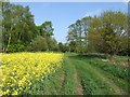
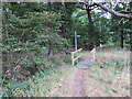
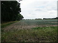
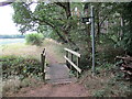
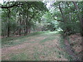
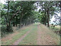
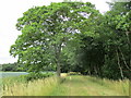
Coningsby & Mareham Ward occupies a distinct corner of rural England, spanning 100.9 square kilometres. You find it in Lincolnshire, an area defined by its openness rather than urban density. The ward holds a population of just over 3,000 people, resulting in a population density of 1,100 people per square kilometre. This figure appears high on paper but reflects the ward's administrative boundaries which include significant rural land. Daily life here revolves around a tight-knit community setting where space is abundant. The environment is predominantly countryside, offering a quiet lifestyle that stands in stark contrast to city living. You are not shopping in a bustling high street or commuting on a packed motorway. Instead, your routine involves local village centres and fields stretching as far as the eye can see. The ward acts as a borough unitary, functioning as a specific administrative unit within the larger county structure. Your neighbours are likely to know your surname, fostering a traditional sense of belonging. This area suits those seeking a slow pace where the clock moves differently.
- Area Type
- District Borough Unitary Ward
- Area Size
- 100.9 km²
- Population
- 3005
- Population Density
- 1100 people/km²
Demographics
The community in Coningsby & Mareham Ward skews significantly older than the national average. The median age sits at 70, confirming that this is a retirement-orientated location. You will find the vast majority of residents fall into older age brackets, reflecting the quiet nature of life here. Home ownership is the standard, with 67% of households owning their property outright or with a mortgage. This high rate suggests stability and long-term residents who have stayed for years. Few people in Coningsby & Mareham Ward rely on renting, making the local market very different from urban centres. Household composition mirrors this age profile, with many homes occupied by single older adults or couples in retirement. Accommodation types generally align with older housing stock suitable for this demographic. You do not see a diverse mix of young professionals or families moving in large numbers. The area maintains a consistent character where older generations form the backbone of society. Living in Coningsby & Mareham Ward means sharing your days with neighbours experiencing the same life stage.
Household Size
Accommodation Type
Tenure
Ethnic Group
Religion
Household Composition
Age
Household Deprivation
NS-SEC
Explore more demographic insights in this area
Go to Demographics tabPlanning
Planning Constraints
- Flood RiskPremium
- Ramsar Wetland SitesPremium
- Area of Outstanding Natural BeautyPremium
- Protected Nature ReservePremium
- Protected WoodlandPremium
- Crime RiskPremium