Area Overview for Coalville West Ward
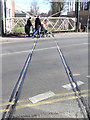
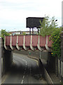
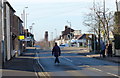
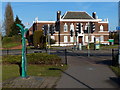
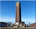
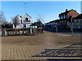
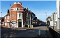
Photos of Coalville West Ward

Area Information
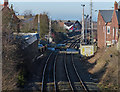
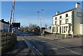
Coalville West Ward occupies a compact 1.1 km² footprint within the North West Leicestershire District. This electoral ward forms part of the unparished central area of Coalville, acting as a geographic corridor along the A511. The road connects Leicester to Burton upon Trent, placing residents in close proximity to M1 junction 22 and the A50. This location offers straightforward access to wider transport networks while keeping you rooted in the historic industrial landscape of the Iron Dudley region. The ward shares coordinates with major landmarks like Snibston Discovery Centre and sits between former mining settlements such as Whitwick and Swannington. You live in a space defined by its history and central positioning rather than by postcodes or separate parish boundaries, as the original urban district was abolished in 1974. Daily life here involves navigating a town that has evolved from nineteenth-century coalmining hubs into a modern community without losing its distinct character. Living in Coalville West Ward means you are part of a district that blends industrial heritage with contemporary convenience. The area functions as a key transit point for the East Midlands, allowing easy movement between cities while maintaining a local identity. You do not experience the isolation found in more rural wards; instead, you benefit from being centrally located within the town structure. This central position influences everything from local services to commute times, making it a practical choice for those who value connectivity alongside community feel. ### The community within Coalville West Ward reflects a pronounced shift towards an older population. Data indicates a median age of 70 years, suggesting the ward serves as a significant retirement destination for many residents. The age profile is heavily weighted towards seniors, with the "Total" age range noted as the most common demographic descriptor in current records. This concentration of older residents shapes the local atmosphere and likely influences the type of amenities that attract new buyers or visitors. Home ownership stands at 51 per cent, creating a balanced environment where neither tenants nor owners dominate the landscape entirely. This figure places Coalville West Ward slightly below the UK national average for home ownership. The housing stock mirrors this blend, comprising both owned and rented accommodation, though specific breakdowns of property tenure types are not detailed in the current data. You may find a mix of retired couples downsizing and families or professionals in long-term rental arrangements. Ethnic diversity and religious affiliation data are not specified in the available records for this specific ward. While the broader County of Leicestershire has diverse populations, the specific predominant ethnic group and religious composition here remain unquantified in this dataset. Without these specific figures, you cannot make precise assumptions about cultural demographics. The higher median age might imply a slower pace of life compared to younger city districts. You are buying into a community defined by stability and settled residents rather than transient populations or rapidly changing demographics. ### The housing market in Coalville West Ward is defined by a clear distinction from high-density urban centres. The ward's small physical size of 1.1 km² limits the volume of new builds compared to larger districts. With a home ownership rate of 51 per cent, the market is split roughly evenly between owners and renters. This suggests you will encounter a wide variety of property types, from established Victorian and Edwardian homes to more recently constructed developments catering to older buyers. Five out of every ten residents in this ward do not own their home outright. This high level of rental participation often indicates a significant stock of purpose-built housing or existing large properties adapted for retirement living. You might find traditional terraced houses, detached bungalows, or semi-detached flats depending on your budget. The lack of specific accommodation type data prevents a detailed breakdown of building styles, but the high median age of 70 strongly suggests a prevalence of bungalows and single-level properties. When viewing homes in Coalville West Ward, you are likely reading titles with substantial history. The ward lacks planning constraints related to protected woodlands, nature reserves, or Areas of Outstanding Natural Beauty. This absence of restrictions allows for standard building regulations to apply, which can make renovation projects straightforward for owner-occupiers. However, the compact nature of the ward means you may find fewer land-rich plots than in the surrounding districts. Buyers looking for homes in Coalville West Ward should prioritise properties with immediate maintenance needs, as the existing stock has been standing for decades. ### Digital connectivity in Coalville West Ward ranks among the highest standards available across the United Kingdom. You receive a fixed broadband quality score of 97 out of 100. This rating indicates an excellent connection suitable for heavy usage, video conferencing, and streaming without interruption. For anyone considering working from home, this infrastructure provides a reliable foundation for your daily digital tasks. The physical transport network remains robust despite the ward's small 1.1 km² area. Coalville sits directly on the A511, the primary arterial route linking Leicester to Burton upon Trent. You pass within walking distance or a short drive of M1 junction 22, where the A511 intersects with the A50. This proximity to a major motorway interchange allows you to reach East Midlands airports and national destinations efficiently. The nearest mainline railway station is Loughborough, located approximately 8 miles or 13 km to the northeast. You must rely on local bus links or private vehicles to reach the train station for intercity travel. While Loughborough offers direct national rail services, your daily commute will likely depend on car ownership given the ward's central road location. This reliance on road networks matches the practical reality of life in an unparished town that has grown organically around historical transport routes. ### You face a medium crime risk in Coalville West Ward, with a safety score of 35 out of 100. This metric places the ward in a category where crime rates are around the regional average. Such a risk level requires standard security precautions, meaning you should not expect exceptional safety but it does not pose an immediate threat. You may see a comparable number of incidents to other average-sized wards in Leicestershire. Environmental and planning constraints offer a different picture of risk. The area has a low flood risk coverage with a safety score of 0 out of 100. This score represents minimal danger from waterlogging or fluvial flooding. You do not need to worry about seasonal river levels affecting your foundation or basement properties. Additionally, there is no Ramsar wetland coverage, no Area of Outstanding Natural Beauty coverage, and no protected nature reserve coverage within the ward boundaries. These zero scores confirm that planning restrictions related to rare habitats do not impact your property purchase or future development potential. The absence of protected woodland coverage further simplifies the planning landscape. You can proceed with confidence knowing that local conservation laws do not impose extraordinary limitations on land use. However, the medium crime rating remains the primary consideration for your peace of mind. This balanced view shows that while the physical environment is safe from natural hazards, standard vigilance regarding personal security is a practical necessity for living here. ### Who typically lives in Coalville West Ward?The median age of residents is 70 years old, making this predominantly an area for retirees. While 51 per cent of households own their homes, the population is not diverse enough to calculate specific ethnic or religious groups based on current data. You are buying into a community of settled, older locals. What is the internet quality like?Fixed broadband quality scores 97 out of 100, indicating an excellent connection. This is one of the highest connectivity scores in the region. You can expect fast speeds suitable for streaming, remote work, and high-bandwidth activities without service interruptions. How safe is the area?Crime risk is rated as medium with a safety score of 35 out of 100. This means crime levels are average for the area, requiring standard security measures. However, the risk of flooding is minimal with a score of 0 out of 100, and there are no planning constraints from protected nature reserves or woodlands. How easy is it to travel from here?You are located on the A511 near M1 junction 22, providing quick access to major roads. The nearest train station is Loughborough, which is about 8 miles or 13 km away. Most residents will rely on the road network for their daily commute and viagens.
- Area Type
- District Borough Unitary Ward
- Area Size
- 1.1 km²
- Population
- Not available
- Population Density
- Not available
Demographics
The community within Coalville West Ward reflects a pronounced shift towards an older population. Data indicates a median age of 70 years, suggesting the ward serves as a significant retirement destination for many residents. The age profile is heavily weighted towards seniors, with the "Total" age range noted as the most common demographic descriptor in current records. This concentration of older residents shapes the local atmosphere and likely influences the type of amenities that attract new buyers or visitors. Home ownership stands at 51 per cent, creating a balanced environment where neither tenants nor owners dominate the landscape entirely. This figure places Coalville West Ward slightly below the UK national average for home ownership. The housing stock mirrors this blend, comprising both owned and rented accommodation, though specific breakdowns of property tenure types are not detailed in the current data. You may find a mix of retired couples downsizing and families or professionals in long-term rental arrangements. Ethnic diversity and religious affiliation data are not specified in the available records for this specific ward. While the broader County of Leicestershire has diverse populations, the specific predominant ethnic group and religious composition here remain unquantified in this dataset. Without these specific figures, you cannot make precise assumptions about cultural demographics. The higher median age might imply a slower pace of life compared to younger city districts. You are buying into a community defined by stability and settled residents rather than transient populations or rapidly changing demographics. ### The housing market in Coalville West Ward is defined by a clear distinction from high-density urban centres. The ward's small physical size of 1.1 km² limits the volume of new builds compared to larger districts. With a home ownership rate of 51 per cent, the market is split roughly evenly between owners and renters. This suggests you will encounter a wide variety of property types, from established Victorian and Edwardian homes to more recently constructed developments catering to older buyers. Five out of every ten residents in this ward do not own their home outright. This high level of rental participation often indicates a significant stock of purpose-built housing or existing large properties adapted for retirement living. You might find traditional terraced houses, detached bungalows, or semi-detached flats depending on your budget. The lack of specific accommodation type data prevents a detailed breakdown of building styles, but the high median age of 70 strongly suggests a prevalence of bungalows and single-level properties. When viewing homes in Coalville West Ward, you are likely reading titles with substantial history. The ward lacks planning constraints related to protected woodlands, nature reserves, or Areas of Outstanding Natural Beauty. This absence of restrictions allows for standard building regulations to apply, which can make renovation projects straightforward for owner-occupiers. However, the compact nature of the ward means you may find fewer land-rich plots than in the surrounding districts. Buyers looking for homes in Coalville West Ward should prioritise properties with immediate maintenance needs, as the existing stock has been standing for decades. ### Digital connectivity in Coalville West Ward ranks among the highest standards available across the United Kingdom. You receive a fixed broadband quality score of 97 out of 100. This rating indicates an excellent connection suitable for heavy usage, video conferencing, and streaming without interruption. For anyone considering working from home, this infrastructure provides a reliable foundation for your daily digital tasks. The physical transport network remains robust despite the ward's small 1.1 km² area. Coalville sits directly on the A511, the primary arterial route linking Leicester to Burton upon Trent. You pass within walking distance or a short drive of M1 junction 22, where the A511 intersects with the A50. This proximity to a major motorway interchange allows you to reach East Midlands airports and national destinations efficiently. The nearest mainline railway station is Loughborough, located approximately 8 miles or 13 km to the northeast. You must rely on local bus links or private vehicles to reach the train station for intercity travel. While Loughborough offers direct national rail services, your daily commute will likely depend on car ownership given the ward's central road location. This reliance on road networks matches the practical reality of life in an unparished town that has grown organically around historical transport routes. ### You face a medium crime risk in Coalville West Ward, with a safety score of 35 out of 100. This metric places the ward in a category where crime rates are around the regional average. Such a risk level requires standard security precautions, meaning you should not expect exceptional safety but it does not pose an immediate threat. You may see a comparable number of incidents to other average-sized wards in Leicestershire. Environmental and planning constraints offer a different picture of risk. The area has a low flood risk coverage with a safety score of 0 out of 100. This score represents minimal danger from waterlogging or fluvial flooding. You do not need to worry about seasonal river levels affecting your foundation or basement properties. Additionally, there is no Ramsar wetland coverage, no Area of Outstanding Natural Beauty coverage, and no protected nature reserve coverage within the ward boundaries. These zero scores confirm that planning restrictions related to rare habitats do not impact your property purchase or future development potential. The absence of protected woodland coverage further simplifies the planning landscape. You can proceed with confidence knowing that local conservation laws do not impose extraordinary limitations on land use. However, the medium crime rating remains the primary consideration for your peace of mind. This balanced view shows that while the physical environment is safe from natural hazards, standard vigilance regarding personal security is a practical necessity for living here. ### Who typically lives in Coalville West Ward?The median age of residents is 70 years old, making this predominantly an area for retirees. While 51 per cent of households own their homes, the population is not diverse enough to calculate specific ethnic or religious groups based on current data. You are buying into a community of settled, older locals. What is the internet quality like?Fixed broadband quality scores 97 out of 100, indicating an excellent connection. This is one of the highest connectivity scores in the region. You can expect fast speeds suitable for streaming, remote work, and high-bandwidth activities without service interruptions. How safe is the area?Crime risk is rated as medium with a safety score of 35 out of 100. This means crime levels are average for the area, requiring standard security measures. However, the risk of flooding is minimal with a score of 0 out of 100, and there are no planning constraints from protected nature reserves or woodlands. How easy is it to travel from here?You are located on the A511 near M1 junction 22, providing quick access to major roads. The nearest train station is Loughborough, which is about 8 miles or 13 km away. Most residents will rely on the road network for their daily commute and viagens.
Household Size
Accommodation Type
Tenure
Ethnic Group
Religion
Household Composition
Age
Household Deprivation
NS-SEC
Explore more demographic insights in this area
Go to Demographics tabPlanning
Planning Constraints
- Flood RiskPremium
- Ramsar Wetland SitesPremium
- Area of Outstanding Natural BeautyPremium
- Protected Nature ReservePremium
- Protected WoodlandPremium
- Crime RiskPremium