Area Overview for Coalville
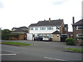
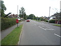
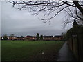
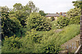
Photos of Coalville


Area Information
Coalville is a built-up area in England, covering 6.6 km², with a population characterised by a median age of 70. This suggests a community where older residents predominate, shaping the area’s social fabric. Daily life in Coalville balances practicality with accessibility, with amenities and services within practical reach. The presence of multiple schools, including Belvoirdale Community Primary School and All Saints Church of England Primary School, highlights the area’s focus on education. For those considering living in Coalville, the combination of a stable population, established infrastructure, and nearby retail and transport options offers a straightforward, no-frills lifestyle. While the area may not appeal to those seeking a younger demographic, its mature population and functional amenities make it a viable choice for buyers prioritising convenience and reliability.
- Area Type
- Built Up Area 250
- Area Size
- 6.6 km²
- Population
- Not available
- Population Density
- Not available
Coalville’s amenities include five retail outlets, such as Spar and Morrisons Hugglescote, offering convenience for daily shopping. The Shackerstone Railway Station provides access to wider transport links, enhancing connectivity for commuters. While the data does not detail parks or leisure facilities, the availability of multiple retail options and a railway station suggests a practical, functional lifestyle. Residents can expect straightforward access to essentials, though those seeking extensive recreational spaces may need to look beyond the immediate area.
Amenities
Schools
Coalville offers several primary schools, including Belvoirdale Community Primary School and All Saints Church of England Primary School, both rated ‘good’ by Ofsted. Warren Hills Community Primary School and Saint Clare’s Catholic Primary School also serve the area, though their Ofsted ratings are not specified. Broom Leys School provides additional options for families. The presence of multiple schools ensures a range of educational choices, with some institutions recognised for their quality. For families prioritising education, the availability of ‘good’-rated schools is a notable advantage, though parents should verify current ratings and facilities before making decisions.
| Rank | School | Type | Entry gender | Ages |
|---|
Explore more schools in this area
Go to Schools tabDemographics
Coalville’s population has a median age of 70, with the most common age range encompassing all demographics. This indicates a community where older residents form a significant proportion, influencing local services and social dynamics. Home ownership sits at 70%, suggesting a mix of long-term residents and property investors. The accommodation types and household compositions are not specified in detail, but the data implies a settled population with established living arrangements. While no specific deprivation data is provided, the age profile may affect access to certain services, such as healthcare or leisure facilities tailored to younger families. Prospective buyers should consider how the area’s demographic profile aligns with their lifestyle needs.
Household Size
Accommodation Type
Tenure
Ethnic Group
Religion
Household Composition
Age
Household Deprivation
NS-SEC
Explore more demographic insights in this area
Go to Demographics tabPlanning
Planning Constraints
- Crime RiskPremium