Area Overview for Clowne East Ward
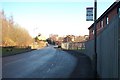
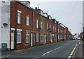
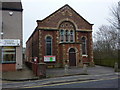
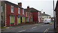
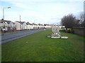
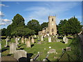
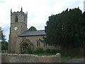
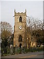
Photos of Clowne East Ward
Area Information
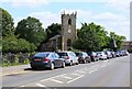
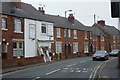
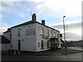
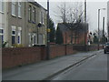
Living in Clowne East Ward offers a settled experience within a compact district borough ward covering just 3.5 square kilometres. This specific area is part of the Clowne district, situated in Derbyshire, England. You will find a neighbourhood characterised by strong community roots and a relatively stable environment. The ward is designed to support residents who value quiet settings rather than dense urban intensity. Daily life here revolves around local amenities and manageable travel distances due to the small footprint. The area suits those seeking a calm residential setting without the complications of larger city centres. You can expect a pace of life that prioritises stability and proximity to essential services. The geography is defined by its modest size, which helps maintain close-knight neighbourhood ties. Homebuyers often find the scale of Clowne East Ward appealing for families or individuals who prefer a defined local boundary for their daily commutes and social interactions. This pocket of Derbyshire provides a clear sense of place without the overwhelming size of major urban zones.
- Area Type
- District Borough Unitary Ward
- Area Size
- 3.5 km²
- Population
- Not available
- Population Density
- Not available
Demographics
The community in Clowne East Ward displays a distinct demographic profile with a median age of 70 years. This figure indicates a population heavily skewed towards older residents compared to the national average. Age data confirms that the total population exists within an older bracket, which shapes the local culture and service requirements. You will find that household composition reflects this older demographic, often involving single households or couples settled into later retirement years. Home ownership stands at a significant 72% of all households in the ward. This high level of ownership suggests a stable resident base with long-term ties to the area. The residential landscape is dominated by privately owned properties rather than rental flats or student accommodation. Accommodation types generally mirror this traditional ownership pattern, favouring established homes over modern apartment blocks. While specific figures on ethnic diversity and religious affiliation are included in the total records, the primary demographic signal is age and tenure. This profile creates a community focused on leisure, retirement, and maintenance rather than transient urban exchange. Buyers should expect neighbours who have contributed to the area for decades.
Household Size
Accommodation Type
Tenure
Ethnic Group
Religion
Household Composition
Age
Household Deprivation
NS-SEC
Explore more demographic insights in this area
Go to Demographics tabPlanning
Planning Constraints
- Flood RiskPremium
- Ramsar Wetland SitesPremium
- Area of Outstanding Natural BeautyPremium
- Protected Nature ReservePremium
- Protected WoodlandPremium
- Crime RiskPremium