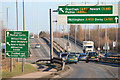
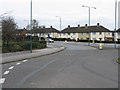
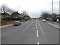
Area Overview for Clifton West Ward
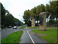
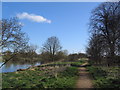
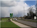
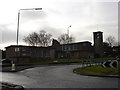
Photos of Clifton West Ward
Area Information
Clifton West Ward is a compact district within Bristol, covering just 5.1 km² with 1,886 residents. The population density stands at 370 people per square kilometre, creating a tightly knit neighbourhood where every street matters. Living in Clifton West Ward means navigating a small, defined geographical space where proximity to amenities is inherent rather than a luxury. The area situated in England reflects a specific community character shaped by its limited size. Residents experience daily life within a contained boundary that fosters close neighbourly interaction. This ward represents a distinct slice of the Clifton landscape, separate from but connected to the broader borough. The physical limits of the area influence everything from local traffic patterns to the visibility of each household. You will find that familiarity with the layout is essential for comfortable settlement. The small footprint ensures that local events and community gatherings have a direct impact on all occupants. This is a place where the environment is intimate and the scale is entirely human.
- Area Type
- District Borough Unitary Ward
- Area Size
- 5.1 km²
- Population
- 1886
- Population Density
- 370 people/km²
Demographics
The community in Clifton West Ward is dominated by older residents, with a median age of 70 years. This age profile defines the social fabric and the pace of daily life throughout the ward. The most common age group aligns with this senior demographic, suggesting a neighbourhood built for retirement or older generations. Home ownership is relatively high at 67%, indicating that most people living in Clifton West Ward possess their residences outright rather than renting. This statistic influences the stability of the population and the long-term investment nature of the local housing stock. Household composition and accommodation type data classify the total population, confirming the prevalence of established homes. The demographic structure suggests a quiet environment where residents have settled for the long term. With such an elderly population, services and facilities likely cater to specific needs regarding health and accessibility. The community feel derives from shared history and established routines that span decades. Living here means interacting with neighbours who have known one another for generations. The high ownership rate further cements a sense of permanence that distinguishes this ward from transient rental districts.
Household Size
Accommodation Type
Tenure
Ethnic Group
Religion
Household Composition
Age
Household Deprivation
NS-SEC
Explore more demographic insights in this area
Go to Demographics tabPlanning
Planning Constraints
- Flood RiskPremium
- Ramsar Wetland SitesPremium
- Area of Outstanding Natural BeautyPremium
- Protected Nature ReservePremium
- Protected WoodlandPremium
- Crime RiskPremium