Area Overview for Claybrooke Parva
Photos of Claybrooke Parva
Area Information
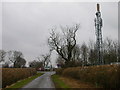
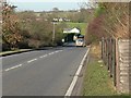
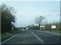
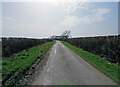
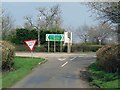
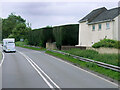
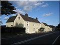
Claybrooke Parva is a civil parish situated in England, covering a total area of 2.3 km². Living in Claybrooke Parva means residing in a compact locality where residents often know their neighbours by name. The small footprint of the parish creates a tight-knit environment that feels distinctly separate from the wider county. You will find the community is defined by stability rather than rapid change. There are no large commercial hubs within the parish bounds, so daily life centres on local provision and connections to the surrounding villages. Homes in Claybrooke Parva are primarily detached properties. This structure reflects the land use and planning history of the settlement. The area maintains a quiet character without the noise and congestion of larger urban centres. You can walk across the entire parish in a matter of minutes. This manageable size makes it easy to patrol or maintain. A civil parish classification indicates local governance structures are in place to manage specific community needs. You will interact with parish councils regarding local issues. The setting offers a clear sense of place. Residents appreciate the defined boundaries and the recognition of their local identity. When you move to Claybrooke Parva, you join a population that values its distinct silhouette on the map.
- Area Type
- Parish
- Area Size
- 2.3 km²
- Population
- Not available
- Population Density
- Not available
Demographics
The community in Claybrooke Parva reflects a settled population with a significant demographic shift away from younger age brackets. The median age sits at 70 years old. This statistic indicates that the area attracts older residents who often seek quieter surroundings in retirement. You will notice that the most common age range spans across the entire adult demographic, with no specific narrow bracket dominating the count. There are 80% owners in the area. This high figure suggests long-term stability and established households rather than transient renters. Home ownership levels indicate that you are likely to buy a property with the intention of staying for many years. Accommodation types align with this ownership pattern. The housing stock supports traditional family units and retired couples. You do not find the high turnover typical of student or temporary rental zones. The household composition is balanced towards stability. While specific data on ethnic diversity is not detailed, the area remains a community defined by its age profile and tenure types. Daughters and sons in later life often move here to reduce stress and cost of living. You will find few young professionals seeking short-term leases. The social fabric is woven from families and retirees. Children in the area often spend most of their time in schools elsewhere. This demographic reality shapes local shops, pubs, and community groups. You should plan your life around a slower pace.
Household Size
Accommodation Type
Tenure
Ethnic Group
Religion
Household Composition
Age
Household Deprivation
NS-SEC
Explore more demographic insights in this area
Go to Demographics tabPlanning
Planning Constraints
- Flood RiskPremium
- Ramsar Wetland SitesPremium
- Area of Outstanding Natural BeautyPremium
- Protected Nature ReservePremium
- Protected WoodlandPremium