Area Overview for Clay Cross South Ward
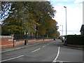
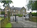
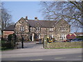
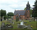
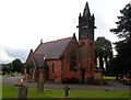
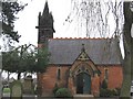
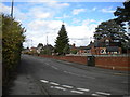
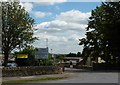
Photos of Clay Cross South Ward
Area Information
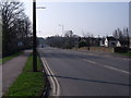
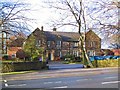
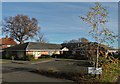
Living in Clay Cross South Ward offers a distinctive semi-rural experience within the North East Derbyshire district of Derbyshire. This electoral division encompasses the wards of Pilsley & Morton, Clay Cross South, and part of North Wingfield. The area covers a total area size of 2.4 km² and sits about 5 miles south of Chesterfield. You are located directly on the A61 road, which provides direct access to the town of Clay Cross, a former industrial and mining town. The character of the area is defined by its dispersed pockets of population. While it retains a connection to its local heritage, the layout is not densely packed. Prospective buyers should understand the scale and positioning of this ward immediately. It is part of the East Midlands region and functions as a civil parish unit. The location offers a specific balance of rural atmosphere and road connectivity. Residents enjoy living in a setting that is removed from major urban sprawl yet remains accessible via the primary arterial route of the region. You can expect a community that dates back to its mining history but maintains a relatively quiet, spread-out domestic life. The coordinates sit at approximately 53.1585°N, 1.4108°W, marking a precise spot in the landscape. This ward represents a specific slice of Derbyshire life for those who prefer lower density environments. You are looking at a community where history meets the present day. The location is defined by its inclusion in the Clay Cross civil parish. This context shapes the daily rhythm for anyone considered moving to Clay Cross South Ward. The size of the ward is compact, yet the geographical spread creates a unique sense of place. You will find that living here means accepting a semi-rural structure within a defined borough boundary. The area serves as a key part of the local community identity for neighbouring towns.
- Area Type
- District Borough Unitary Ward
- Area Size
- 2.4 km²
- Population
- Not available
- Population Density
- Not available
Demographics
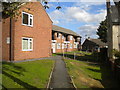
The community demographics in Clay Cross South Ward present a mature profile that you should consider carefully. The median age for residents is 70 years. This figure indicates that the ward has a significantly older population compared to national averages. When housing families or deciding on long-term suitability, you must recognise that the most common age categories skew heavily towards this higher bracket. The data records the age group simply as "Age: Total" without breaking down younger cohorts in the primary figures provided. Home ownership reaches a solid 55% level across the ward. This statistic tells you that the market is balanced between those who buy and those who rent or own with a mortgage. However, the high median age suggests that the primary demographic driving this ownership figure consists of retirees or older established households. Accommodation types and household composition data are recorded as "total" in the available records, meaning specific breakdowns of family versus single-person households are not explicitly detailed in the current dataset. You will find that the area does not highlight specific predominant ethnic groups or detailed religious affiliations in the primary summary data. This lack of granular diversity statistics does not diminish the stability of the community but does mean you should research local faiths or cultural groups independently. The high median age reverberates through every facet of community life, from local consumer spend to school demographic potential. If you are considering Clay Cross South Ward, you are entering an area anchored by an older demographic structure. This profile shapes the local amenities you will find, which often cater to older residents. The quality of life here is heavily influenced by this age concentration. You are not looking at a youthful, family-centric growth zone based on these figures. Instead, the ward reflects a settled, mature population. This reality helps you forecast the neighbourly dynamics and the pace of daily social life in your proposed new home.
Household Size
Accommodation Type
Tenure
Ethnic Group
Religion
Household Composition
Age
Household Deprivation
NS-SEC
Explore more demographic insights in this area
Go to Demographics tabPlanning
Planning Constraints
- Flood RiskPremium
- Ramsar Wetland SitesPremium
- Area of Outstanding Natural BeautyPremium
- Protected Nature ReservePremium
- Protected WoodlandPremium
- Crime RiskPremium