Area Overview for Clay Coton
Photos of Clay Coton


Area Information
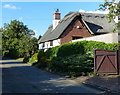
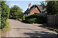
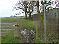
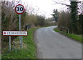
Clay Coton is a small civil parish in England covering an area of just four square kilometres. This compact size defines the daily rhythm of life for residents, creating an intimate sense of place. The community is characterised by a settled population, resulting in a predictable and steady environment for those considering living in Clay Coton. You will find the area offers a contained village experience where distances are short and the local geography is well known. The physical boundaries of the parish mean that walking or driving between key points takes very little time. This spatial efficiency supports a lifestyle where local interactions remain central to daily routines. Prospective buyers seeking a defined neighbourhood without the sprawl of larger towns will appreciate the clear limits of this settlement. The area stands as a distinct locality where the compact layout fosters a direct connection to your immediate surroundings. Homes in Clay Coton sit within a framework that prioritises proximity and simplicity over extensive infrastructure. You can expect a living environment where the physical space is intuitive and easily navigable. The small footprint of the parish ensures that you remain close to your local amenities and community hubs. Living here means getting direct access to the local character of the settlement without unnecessary travel. The geography of this four-kilometre zone supports a focused way of life for anyone moving into the area.
- Area Type
- Parish
- Area Size
- 4.0 km²
- Population
- Not available
- Population Density
- Not available
Demographics
The community in Clay Coton is shaped by a distinct age profile, with a median age of seventy years. This figure indicates that the population skews heavily towards older residents compared to the national average. You are likely to encounter a neighbourhood where established households dominate the streetscapes. The high median age suggests a strong presence of retirees or those staying through later life stages. Home ownership stands at an impressive seventy-nine percent, meaning the vast majority of people living here own their residences outright or with a mortgage. This high rate of ownership reinforces the demographic trend towards a settled, resident population rather than short-term tenants or commuters. The household composition data confirms that the total makeup of families aligns with this older demographic, likely featuring single-person households or couples living together. When you look at the accommodation and ethnic diversity metrics, the total figures reflect a consistent community structure without sudden shifts in population characteristics. This stability provides a clear picture of who lives in Clay Coton. You can expect a quiet atmosphere where long-term residents form the core of the social fabric. The demographic landscape presents a specific type of community for new arrivals to understand and integrate with.
Household Size
Accommodation Type
Tenure
Ethnic Group
Religion
Household Composition
Age
Household Deprivation
NS-SEC
Explore more demographic insights in this area
Go to Demographics tabPlanning
Planning Constraints
- Flood RiskPremium
- Ramsar Wetland SitesPremium
- Area of Outstanding Natural BeautyPremium
- Protected Nature ReservePremium
- Protected WoodlandPremium
- Crime RiskPremium