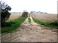
Area Overview for Claxby St. Andrew
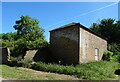
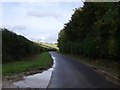
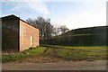
Photos of Claxby St. Andrew
Area Information
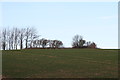
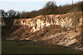
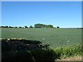
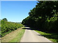
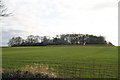
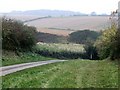
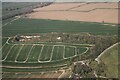
You find Claxby St. Andrew to be a compact civil parish covering approximately 4.4 square kilometres of land. This small footprint shapes the character of daily life, creating a neighbourhood where distances are short and the environment feels intimate. While specific population figures are not included in the available records, the sheer size of the parish suggests a settled, rural community rather than a sprawling urban district. Living in Claxby St. Andrew means accepting a lifestyle defined by this limited geographical scope. You will navigate the entire area without much travel, relying on local amenities found within these boundaries. The parish is characterised by its rural nature, offering a quiet escape from the busier streets of surrounding towns. There are no large commercial centres or dense high-rises within the 4.4 km² boundary, ensuring that the built environment remains consistent with its parish designation. This simplicity defines the experience for anyone considering homes in Claxby St. Andrew. You can expect a setting where the landscape dictates the pace of life, and the local geography remains a constant feature of your routine. The area is distinct for its contained size and its classification as a civil parish within England.
- Area Type
- Parish
- Area Size
- 4.4 km²
- Population
- Not available
- Population Density
- Not available
Demographics
The community in Claxby St. Andrew is notably older than many other parts of the country. The median age stands at exactly 70 years, indicating a population dominated by older residents. Most of the people living in this parish fall into the category marked as Age Total, reflecting a uniform grouping without significant variation to specific sub-ranges. You will not find a large cohort of young families or students moving to the area, as the age profile points firmly towards retirement or established elderly households. This demographic reality shapes the social fabric and the types of services required by inhabitants. Home ownership sits at a high level of 78%, showing that the majority of residents have purchased their properties rather than renting. This statistic reinforces the view of Claxby St. Andrew as a locality for those seeking stability and long-term residence. The high rate of ownership also suggests strong community ties and investment in the local property stock. While ethnicity, religion, and household composition details are listed as total figures in the data, the low home ownership percentage would be expected to show differences from more urban areas. The clear picture is of a well-established neighbourhood where the older population has settled down for a significant period.
Household Size
Accommodation Type
Tenure
Ethnic Group
Religion
Household Composition
Age
Household Deprivation
NS-SEC
Explore more demographic insights in this area
Go to Demographics tabPlanning
Planning Constraints
- Flood RiskPremium
- Ramsar Wetland SitesPremium
- Area of Outstanding Natural BeautyPremium
- Protected Nature ReservePremium
- Protected WoodlandPremium
- Crime RiskPremium