Area Overview for Clawson, Hose and Harby
Photos of Clawson, Hose and Harby


Area Information
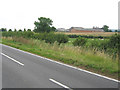
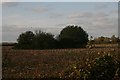
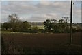
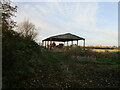
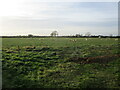
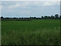
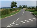
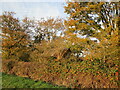
Living in Clawson, Hose and Harby offers a distinct experience within a civil parish that spans 32.3 km² across England. This area is defined by its substantial size relative to its population density, creating a landscape where residents often enjoy spacious surroundings. The neighbourhood operates without major planning constraints such as Areas of Outstanding Natural Beauty or Ramsar wetland sites, which influences the character of development here. You will find that daily life involves navigating a community where the built environment and natural spaces coexist within this specific geographic boundary. Prospective buyers should note that the parish functions as a defined administrative unit with clear boundaries. The lack of protected status for woodland or nature reserves within this zone suggests a more flexible approach to land use compared to other rural designations. Residents here navigate an area where the 32.3 square kilometre footprint dictates the layout of properties and public spaces. While specific village centres are not detailed in the current overview, the overall parish structure provides a framework for local governance and community services. Understanding the scale of this parish is essential when considering how far you need to travel for amenities outside the immediate locality. The area presents a straightforward proposition for those seeking space without the restrictions found in more heavily protected rural zones.
- Area Type
- Parish
- Area Size
- 32.3 km²
- Population
- Not available
- Population Density
- Not available
Demographics
The community within Clawson, Hose and Harby exhibits a notably mature demographic profile, with a median age of 70 years. This figure indicates that the population is significantly older than the national average, shaping the local needs and social atmosphere. Out of the total population, the age distribution leans heavily towards seniors, meaning the area functions primarily as a retirement or long-term residence district rather than a young family hub. Home ownership stands at an impressive 77% of the total households. This high rate suggests a stable community where most residents have settled permanently rather than renting temporarily. The remaining 23% of households are likely rented properties or second homes, contributing to the entrenched nature of the local ownership base. When assessing accommodation types, the data reflects a total picture that aligns with this high ownership rate. The prevailing household composition reinforces the idea that this is an established area where long-term residents maintain a strong connection to their properties. Ethnic diversity and religious affiliation data are not explicitly detailed in the current records, preventing a specific breakdown of the cultural makeup. However, the sheer concentration of older, owner-occupied homes paints a clear picture of the social fabric. You are entering a neighbourhood where familiarity with neighbours is likely the norm, driven by the life stage of the inhabitants. This demographic reality means local services and community events may be tailored towards the needs of an older population.
Household Size
Accommodation Type
Tenure
Ethnic Group
Religion
Household Composition
Age
Household Deprivation
NS-SEC
Explore more demographic insights in this area
Go to Demographics tabPlanning
Planning Constraints
- Flood RiskPremium
- Ramsar Wetland SitesPremium
- Area of Outstanding Natural BeautyPremium
- Protected Nature ReservePremium
- Protected WoodlandPremium
- Crime RiskPremium