Area Overview for Clarborough and Welham
Photos of Clarborough and Welham

Area Information
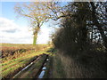
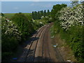
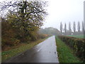
Clarborough and Welham stands as a small, established civil parish covering an area of exactly 9.0 km². This parish offers a contained environment where daily life often revolves around local essentials rather than distant city centres. The setting provides a distinct physical boundary which shapes how residents navigate their surroundings and interact with the wider region. You will find that the scale of the parish ensures a contained community feel without the sprawl of larger urban districts. The geographical limits create a neighbourhood where distances are short, and the local landscape remains the primary backdrop to your daily routines. Life here is defined by its modest dimensions and its position as a recognized civil parish within the local government structure. The area size suggests that travel times are generally brief, making walkability a viable option for many errands within the parish limits. For those considering living in Clarborough and Welham, the compact nature of the 9.0 km² footprint means you are not dealing with long commutes across vast distances. Instead, your focus shifts to how your home connects to the immediate local services and the surrounding transport network. This is a location where the definition of a neighbourhood remains tight and manageable. You will engage with a community that is physically close, bounded by the specific measurements that define this parish on any map.
- Area Type
- Parish
- Area Size
- 9.0 km²
- Population
- Not available
- Population Density
- Not available
Demographics
The community in Clarborough and Welham is heavily weighted towards older residents, with a median age of 70 years. This demographic profile indicates a neighbourhood where retirement communities and long-term established families dominate the resident population. You will encounter a society where the average household includes either elderly couples or individuals living alone rather than young families with dependent children. The high home ownership rate of 83% reinforces this picture, demonstrating that the vast majority of people living here are settled buyers, not temporary renters. Such a high level of ownership typically correlates with deeper community roots and stability within the parish. Accommodation types reflect this static population, with the general total offering a snapshot of a place that does not churn quickly. The breakdown shows that the standard living arrangements consist of permanent residences rather than transient housing solutions. You will see fewer seasonal fluctuations as the residents plan their lives around decades of local history and ownership. The diversity data, while showing total figures, points to a community bound by nationality and tenure patterns typical of the English countryside. Safety assessments further confirm this stable environment, with a crime risk score of 80/100 indicating below-average crime rates. Living in Clarborough and Welham means joining a quiet, settled group where most neighbours have stakes in the area for very long periods.
Household Size
Accommodation Type
Tenure
Ethnic Group
Religion
Household Composition
Age
Household Deprivation
NS-SEC
Explore more demographic insights in this area
Go to Demographics tabPlanning
Planning Constraints
- Flood RiskLocked
- Ramsar Wetland SitesLocked
- Area of Outstanding Natural BeautyLocked
- Protected Nature ReserveLocked
- Protected WoodlandLocked
- Crime RiskLocked