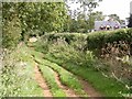
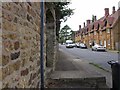
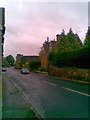
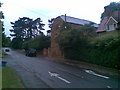
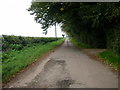
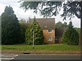
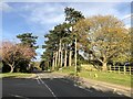
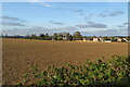
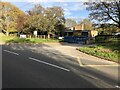
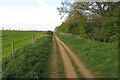
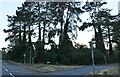
Area Overview for Church with Chapel Brampton
Photos of Church with Chapel Brampton
Area Information
Living in Church with Chapel Brampton offers a distinct retirement-focused experience within a compact civil parish. This settlement covers just 9.8 square kilometres, creating a defined and intimate space where residents often know their neighbours. The area's character is shaped by its demographic reality; it is a community defined by maturity and stability rather than transient energy. You will find that daily life here moves at a considered pace, suitable for those seeking a quiet residence away from the larger towns and cities of the surrounding region. The small size of the parish, when coupled with a settled population, fosters a close-knit environment where local services and community interactions are paramount. Prospective buyers considering this location should understand that Church with Chapel Brampton is not a place for rapid urban growth or extensive development. Instead, it remains a static, low-density area where the fabric of the community is already established. This consistency offers a reliable backdrop for retirement living, allowing residents to enjoy a predictable environment without the disruptions common in larger, evolving market areas.
- Area Type
- Parish
- Area Size
- 9.8 km²
- Population
- Not available
- Population Density
- Not available
Demographics
The community profile of Church with Chapel Brampton is overwhelmingly dominated by older residents, reflecting its status as a retirement parish. You are looking at a median age of 70 years, which accurately describes the typical household head. This age distribution places the area firmly within the retirement sector, with the majority of your potential neighbours drawn from the 70-plus demographic. Home ownership is exceptionally high in Church with Chapel Brampton, standing at 76 per cent of all households. This figure indicates a very stable population with little turnover, as most residents have secured their long-term accommodation through purchase rather than renting. Consequently, the housing stock is likely consistent, with properties suited to the needs of older adults forming the backbone of the local market. While specific details on household composition minority groups and religious affiliations are not provided in the current records, the high ownership rate suggests a community built on long-term settlement. Residents here have a strong stake in the local area, contributing to a quiet and enduring social fabric that changes slowly over time.
Household Size
Accommodation Type
Tenure
Ethnic Group
Religion
Household Composition
Age
Household Deprivation
NS-SEC
Explore more demographic insights in this area
Go to Demographics tabPlanning
Planning Constraints
- Flood RiskPremium
- Ramsar Wetland SitesPremium
- Area of Outstanding Natural BeautyPremium
- Protected Nature ReservePremium
- Protected WoodlandPremium
- Crime RiskPremium