Area Overview for Chesterfield
Photos of Chesterfield

Area Information
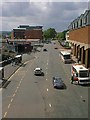
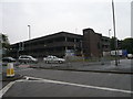
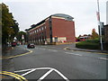
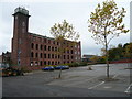
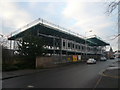
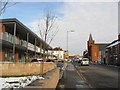
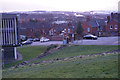
Staying in The Borough of Chesterfield offers a distinct character that dates back to its ancient borough origins. Established as a district in 1974, the area encompasses the historic town alongside settlements like Staveley and villages including Brimington and Old Whittington. You will find yourself part of a community that spans 24.1 square kilometres, hosting a population of 22,653 residents. The borough maintains a non-metropolitan status within East Midlands region, Derbyshire, England. Its history echoes through its mayoral tradition, which has continued since 1598 under the current structure. Life here revolves around the main urban centre, which provides access to major transport links. The location is defined by its proximity to North East Derbyshire and Bolsover districts, creating a defined yet accessible border region. Whether you are looking at homes in Chesterfield or exploring quieter hamlets like Duckmanton and Hollingwood, the geography remains compact. Most daily life centres on the main town streets, with the broader borough providing the larger context. This setting offers a known boundary for those seeking a recognised local authority district with established municipal roots. The area combines historical depth with the practical infrastructure of a modern residential zone.
- Area Type
- District/Borough
- Area Size
- 24.1 km²
- Population
- 22653
- Population Density
- 940 people/km²
Demographics
The community profile of Chesterfield reveals a notably mature population. You will find that the median age sits at 70 years, indicating a significant proportion of older residents compared to the national average. The most common age grouping is simply categorised as Total, reflecting the broad distribution across the borough. With 65 per cent of households owning their homes, the area shows a strong commitment to property ownership rather than long-term renting. This high ownership rate suggests stability within the neighbourhoods surrounding the town centre. The composition data indicates that the total household makeup drives the local character, with no single demographic dominating the scene entirely. Accommodation types span the full spectrum available within the borough, catering to varied living needs. Ethnically and religiously, the data reflects the total population mix without singling out specific groups as predominant. For those considering living in Chesterfield, this demographic snapshot means a quieter, perhaps more settled environment than younger, transient cities. The lack of provided breakdowns on specific ethnic or religious majorities means we rely on the overarching total population figure. You should expect a community where decisions and local life largely reflect the needs of a older, owner-occupied demographic. This shapes the pace of daily life in both the urban wards and the surrounding villages.
Household Size
Accommodation Type
Tenure
Ethnic Group
Religion
Household Composition
Age
Household Deprivation
NS-SEC
Explore more demographic insights in this area
Go to Demographics tabPlanning
Planning Constraints
- Crime RiskPremium