Area Overview for Chapel West Ward
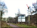
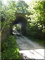
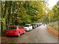
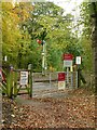
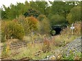
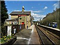
Photos of Chapel West Ward


Area Information
Living in Chapel West Ward offers a defined residential experience within a compact footprint. This district borough unitary ward covers an area of 3.0 km², creating a close-knit environment where daily life revolves around local community rather than sprawling suburban distances. The character of the area is shaped by its history and current demographics, reflecting a settlement entirely within England's regional landscape. You will find a neighbourhood where the streets and housing stock cater to long-term residents rather than transient populations. The ward functions as a distinct pocket of larger administrative structures, providing a clear sense of locality without the chaos of a major city centre. Residents here experience a lifestyle anchored in stability, with boundaries that encourage interaction between neighbours. The size of the ward means that amenities and transport links are likely felt as part of an immediate environment rather than distant destinations. When moving to Chapel West Ward, you are entering a space defined by specific geographical limits and a population that has established deep roots. This clarity of area boundaries helps in understanding local governance and community planning decisions. The ward presents a straightforward proposition for those seeking an area with defined edges and a coherent identity within the broader borough.
- Area Type
- District Borough Unitary Ward
- Area Size
- 3.0 km²
- Population
- Not available
- Population Density
- Not available
Demographics
The community in Chapel West Ward is distinctly mature, driven by a median age of 70 years. This statistic defines the social fabric of the area, indicating that the majority of residents are senior citizens or older adults. The age profile suggests a generation that has likely lived in the same homes or neighbourhoods for decades, rather than a mix of young professionals and families. This demographic reality shapes the local services, leisure activities, and general pace of life you would encounter. It means the area is tailored to the needs of an older population, potentially offering quieter streets and specific community support networks. Home ownership stands as a dominant feature of this demographic landscape, with 78% of households owned outright or with a mortgage. This high figure contrasts sharply with typical rental markets found in major urban centres or student hubs. You are significantly more likely to be buying a home to settle permanently than seeking a short-term rental arrangement. The local economy reflects this stability through long-term residency patterns rather than high turnover rates. Accommodation types align with this ownership model, prioritising dwellings suitable for life's later stages rather than the high-rise blocks common near universities. The community feels like a retirement settlement or established village, where neighbours know each other well and family dynamics centre on extended kinship rather than nuclear isolation.
Household Size
Accommodation Type
Tenure
Ethnic Group
Religion
Household Composition
Age
Household Deprivation
NS-SEC
Explore more demographic insights in this area
Go to Demographics tabPlanning
Planning Constraints
- Flood RiskPremium
- Ramsar Wetland SitesPremium
- Area of Outstanding Natural BeautyPremium
- Protected Nature ReservePremium
- Protected WoodlandPremium
- Crime RiskPremium