Area Overview for Chapel St. Leonards
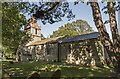
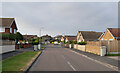
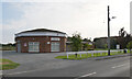
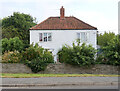
Photos of Chapel St. Leonards
Area Information
Living in Chapel St. Leonards means residing in a compact urban district covering just eight square kilometres. This borough unitary ward sits within the wider context of England, offering a dense living environment rather than sprawling suburbs. The area functions as a complete neighbourhood where daily life revolves around local familiarity and established routines. Prospective homebuyers considering Chapel St. Leonards find a space defined by its specific boundaries and distinct character. You move through a defined community ground that prioritises established patterns over new development trends. The sheer size of the area contributes to a sense of containment, creating a clear perimeter for your day-to-day movements. Residents navigate this eight-square-kilometre footprint with ease, knowing exactly what surrounds their homes. The location does not offer vast expanses, which suits those who prefer a concentrated environment over spread-out estates. Your daily commute or local walk involves traversing this specific, well-defined space. Chapel St. Leonards presents a singular option for those seeking a particular type of settlement within the region. You must decide if this compact scale fits your lifestyle preferences. The area stands as a self-contained unit where the boundaries are clear and the community is tightly knit.
- Area Type
- District Borough Unitary Ward
- Area Size
- 8.0 km²
- Population
- Not available
- Population Density
- Not available
Demographics
The community in Chapel St. Leonards reflects a settled population with a median age of seventy years. This demographic profile indicates that the primary residents belong to the senior age bracket. You are buying into an area where most neighbours are retired or approaching retirement. The age range data confirms that Total is the most common category for the population spread. This concentration of older residents shapes the social fabric of the neighbourhood significantly. Home ownership stands at seventy-two per cent within Chapel St. Leonards, reinforcing the stability of the established population. A substantial majority of households own their properties outright or with a mortgage rather than renting. This high ownership rate suggests long-term residents who have invested in their local environment. You are less likely to find frequent turnover of tenants compared to renting-focused districts. The accommodation type data supports the view of a static, owner-occupier market rather than a transient rental hub. Diversity metrics show Total as the predominant metric for ethnic groups and religion in the available records. This phrasing indicates a complex demographic picture that does not simplify into single categories. You should expect a traditional community structure that may reflect historical settlement patterns. The demographics present a clear picture of an older, predominantly owner-occupied settlement. This stability offers quiet streets and predictable neighbourly interactions.
Household Size
Accommodation Type
Tenure
Ethnic Group
Religion
Household Composition
Age
Household Deprivation
NS-SEC
Explore more demographic insights in this area
Go to Demographics tabPlanning
Planning Constraints
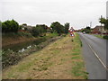
- Flood RiskPremium
- Ramsar Wetland SitesPremium
- Area of Outstanding Natural BeautyPremium
- Protected Nature ReservePremium
- Protected WoodlandPremium
- Crime RiskPremium