Area Overview for Chaddesden North Ward
Photos of Chaddesden North Ward
Area Information
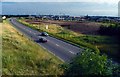
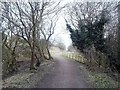
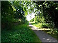
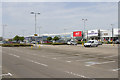
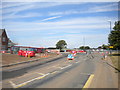
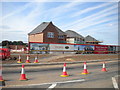
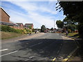
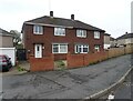
Living in Chaddesden North Ward means residing within a compact residential pocket that forms part of the northern suburbs of Derby. This electoral ward covers just 2.5 km², yet it accommodates a population of 1,471 residents. You will find this area located to the east of Derby city centre, situated north of the River Derwent and the busy A52 trunk road. The neighbourhood is characterised by post-war semi-detached housing, bungalows, and flats arranged in grid layouts or cul-de-sac patterns.不起眼的 rural origins have given way to a defined suburban feel, with major housing development occurring during the interwar and post-war periods. The parish integrates into the broader City of Derby unitary authority, creating a setting that feels both established and community-focused. Daily life revolves around residential streets separated from commercial uses to the south by the A52. A substantial district park offers a key urban break nearby, providing space for formal and informal recreation. You are walking distance from a local library and allotments, which are integrated into the local amenities. The area also features a conservation area at Highfield Cottages, protecting listed former railway cottages just north of the main road. Nottingham Road Cemetery sits nearby as a historic park and garden, adding to the local character. This ward is also home to Lees Brook School playing fields within a green wedge to the north. For those considering homes in Chaddesden North, the layout prioritises quiet residential living while maintaining proximity to major transport links.
- Area Type
- District Borough Unitary Ward
- Area Size
- 2.5 km²
- Population
- 1471
- Population Density
- 595 people/km²
Demographics
Chaddesden North Ward presents a community defined by an older population compared to many urban zones. The median age stands at 70, indicating that the residents are predominantly senior. This age profile is reflected in the accommodation stock, which includes a significant number of bungalows alongside traditional semi-detached homes. You will find that 63% of households are owner-occupiers, suggesting a stable, settled community where families have long roots. The remaining residents likely reside in the flats that are integrated into the grid-like street patterns of the ward. While specific data on household composition and predominant ethnic groups are recorded as totals in the available records, the high home ownership rate points to a sector where residents are invested in their local environment. The low population density of 595 people per km² creates a quieter atmosphere than you might expect within city boundaries. This demographic makes the area particularly suitable for retirees or those seeking a quieter life, as evidenced by the median age figure. The history of the parish, which developed from a rural village centred on the ancient church of St Mary the Virgin, supports a slower pace of life. Living in Chaddesden North Ward means you are part of a settled community where the population structure supports a dignified retirement environment.
Household Size
Accommodation Type
Tenure
Ethnic Group
Religion
Household Composition
Age
Household Deprivation
NS-SEC
Explore more demographic insights in this area
Go to Demographics tabPlanning
Planning Constraints
- Flood RiskPremium
- Ramsar Wetland SitesPremium
- Area of Outstanding Natural BeautyPremium
- Protected Nature ReservePremium
- Protected WoodlandPremium
- Crime RiskPremium