Area Overview for Chaddesden East Ward
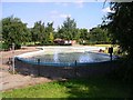
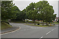
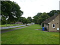
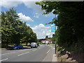
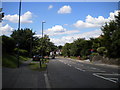
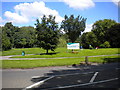
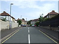
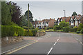
Photos of Chaddesden East Ward

Area Information
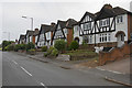
Chaddesden East Ward is a small, defined district within Derby, covering an area of just 2.9 km². Living in this compact ward means you are immediately aware of your local surroundings because boundaries are clearly demarcated within the city borough unitary structure. Most residents are older adults, shaped by a community where the average age settles at 70 years. This demographic profile defines the daily rhythm of the area, distinguishing it from younger, growing suburbs elsewhere in the city. You will find that the neighbourhood is established and settled rather than transient. The walls around a typical property here tell a story of long-term stability. With a median age this high, you can expect quiet streets and established gardens more than bustling nightlife or rapid demographic shifts. The ward operates as a cohesive unit where local services and neighbours know each other well. This specific concentration of residents creates a distinct character that differs from broader city averages. When you consider buying a home in Chaddesden East Ward, you are entering a mature environment where the primary activity revolves around resident comfort and established community patterns.
- Area Type
- District Borough Unitary Ward
- Area Size
- 2.9 km²
- Population
- Not available
- Population Density
- Not available
Demographics
The community in Chaddesden East Ward is dominated by older residents, with a median age of 70 years. Most people here fall into the senior age bracket, which influences the type of social groups and local events. Ownership culture is strong, as 70% of households own their homes outright. This figure indicates a settled population that has stayed for decades rather than moving frequently. The remaining 30% of residents likely rent, suggesting a smaller proportion of tenants compared to typical younger city areas. Household composition and accommodation types reflect this ownership dominance. Families here are often multi-generational or downsided seniors choosing stability. Ethnic diversity and religious affiliations are present but not highlighted as primary defining features in the available records; instead, age and tenure define the social fabric. Because home ownership is so prevalent, the area feels like a community of permanent residents. This stability means you will encounter neighbours who view the ward as their long-term base. You do not see a high churn rate of young professionals or seasonal movers. The demographic makes sense of the quiet atmosphere and the focus on amenities suitable for older age groups.
Household Size
Accommodation Type
Tenure
Ethnic Group
Religion
Household Composition
Age
Household Deprivation
NS-SEC
Explore more demographic insights in this area
Go to Demographics tabPlanning
Planning Constraints
- Flood RiskPremium
- Ramsar Wetland SitesPremium
- Area of Outstanding Natural BeautyPremium
- Protected Nature ReservePremium
- Protected WoodlandPremium
- Crime RiskPremium