Area Overview for Careby Aunby and Holywell
Photos of Careby Aunby and Holywell
Area Information
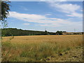
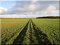
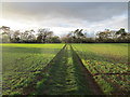
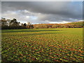
Living in Careby Aunby and Holywell means residing within a compact civil parish that spans 13.9 square kilometres. This quiet settlement sits in the historical county of Flintshire, offering a compact living environment where residents benefit from a definitive sense of locality without the density of larger towns. The area functions as a traditional parish community rather than a bustling commercial hub, which suits those seeking a pace of life dictated by the surrounding landscape rather than traffic or crowds. Daily life here revolves around local amenities within a finite footprint, creating a self-contained experience for homeowners and families alike. You will find that the character of the parish is defined by its small size, which fosters a tight-knit social structure despite the lack of major urban centres nearby. The distinction of being a registered civil parish provides a clear administrative boundary and identity for the neighbourhood. Prospective buyers considering homes in Careby Aunby and Holywell should note that the area's limited dimensions mean that distances between homes, local shops, and green spaces remain short. This layout is ideal for those who prioritise a caravan or mobile lifestyle, water sports, fishing, or short walks close to home. The parish delivers a straightforward, uncluttered environment where the focus remains on home life rather than navigating complex city infrastructure.
- Area Type
- Parish
- Area Size
- 13.9 km²
- Population
- Not available
- Population Density
- Not available
Demographics
The community profile of Careby Aunby and Holywell diverges sharply from national averages, reflecting a distinct settlement pattern. You will find a resident population with a median age of 70 years, indicating that the area attracts or retains an older demographic. This age profile suggests a neighbourhood heavily populated by retirees or long-term residents who have lived in the parish for many decades. The high concentration of older adults shapes the daily rhythm of the community, likely prioritising quiet streets and accessible housing over high-energy youth amenities. Home ownership stands as a defining feature of this locality, with 82% of households reporting ownership of their properties. This statistic underscores a community where stability is the norm rather than the exception. Renting is uncommon here, and outside investment developers rarely compete with existing owners. Consequently, the social fabric relies on established neighbours rather than a transient population. While specific breakdowns regarding household composition, accommodation types, and ethnicity are not detailed in the current records, the overwhelming dominance of owner-occupied stock points to a monolithic community structure.
Household Size
Accommodation Type
Tenure
Ethnic Group
Religion
Household Composition
Age
Household Deprivation
NS-SEC
Explore more demographic insights in this area
Go to Demographics tabPlanning
Planning Constraints
- Flood RiskPremium
- Ramsar Wetland SitesPremium
- Area of Outstanding Natural BeautyPremium
- Protected Nature ReservePremium
- Protected WoodlandPremium
- Crime RiskPremium